Stroud North Topo Map Oklahoma
To zoom in, hover over the map of Stroud North
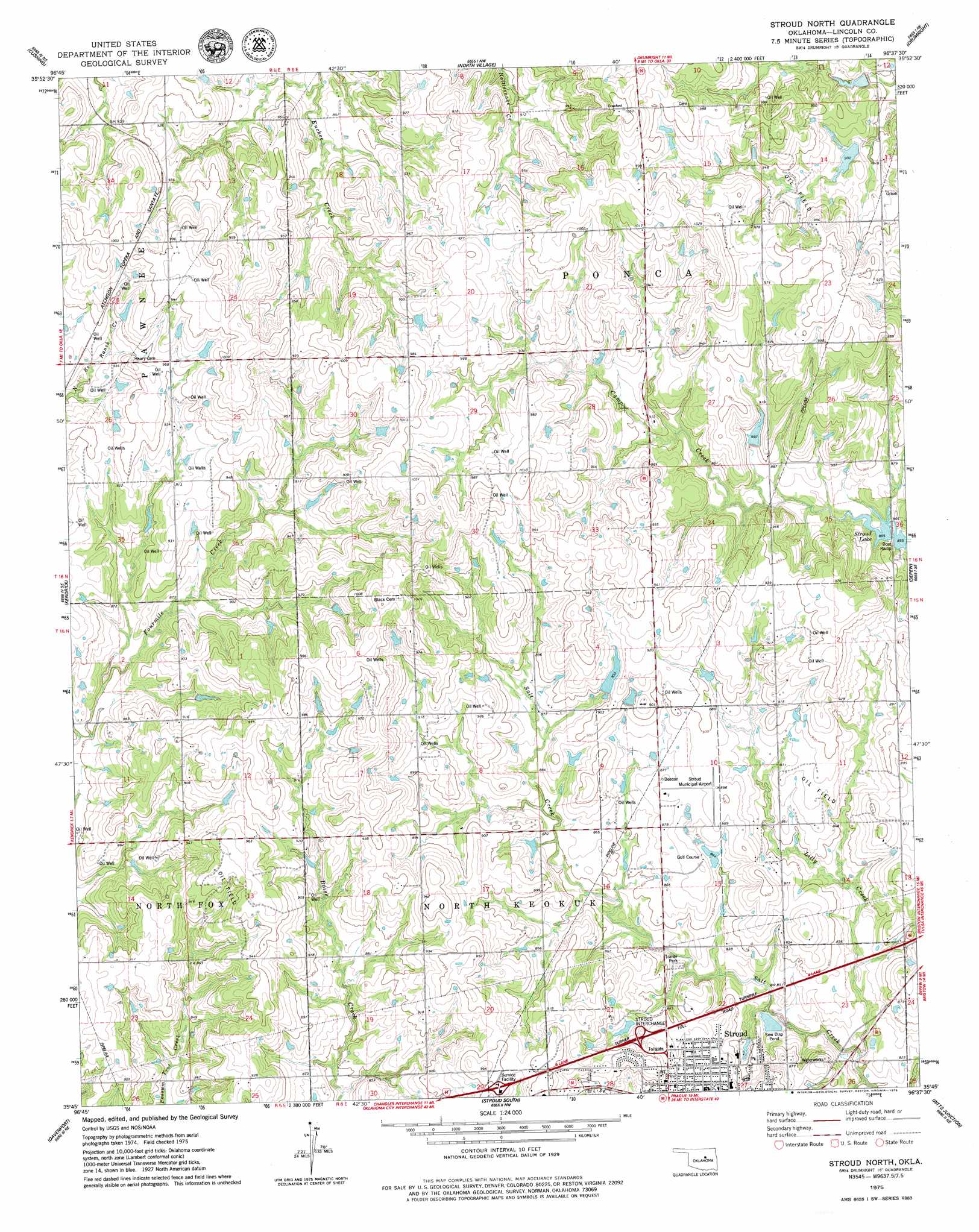
USGS Topo Quad 35096g6 - 1:24,000 scale
| Topo Map Name: | Stroud North |
| USGS Topo Quad ID: | 35096g6 |
| Print Size: | ca. 21 1/4" wide x 27" high |
| Southeast Coordinates: | 35.75° N latitude / 96.625° W longitude |
| Map Center Coordinates: | 35.8125° N latitude / 96.6875° W longitude |
| U.S. State: | OK |
| Filename: | o35096g6.jpg |
| Download Map JPG Image: | Stroud North topo map 1:24,000 scale |
| Map Type: | Topographic |
| Topo Series: | 7.5´ |
| Map Scale: | 1:24,000 |
| Source of Map Images: | United States Geological Survey (USGS) |
| Alternate Map Versions: |
Stroud North OK 1975, updated 1979 Download PDF Buy paper map Stroud North OK 2009 Download PDF Buy paper map Stroud North OK 2012 Download PDF Buy paper map Stroud North OK 2016 Download PDF Buy paper map |
1:24,000 Topo Quads surrounding Stroud North
Ripley |
Twin Mounds |
Yale |
Oilton |
Olive |
Tryon North |
Cushing |
North Village |
Drumright |
Bellvue |
Tryon South |
Kendrick |
Stroud North |
Depew |
Bristow |
Chandler |
Davenport |
Stroud South |
Ritts Junction |
Gypsy |
Meeker |
Sparks |
Arlington |
Paden |
Welty |
> Back to 35096e1 at 1:100,000 scale
> Back to 35096a1 at 1:250,000 scale
> Back to U.S. Topo Maps home
Stroud North topo map: Gazetteer
Stroud North: Airports
Stroud Municipal Airport elevation 270m 885′Stroud North: Crossings
Stroud Interchange elevation 269m 882′Stroud North: Dams
Oknoname 08109 Dam elevation 268m 879′Stroud Sewage Lagoon Dam elevation 246m 807′
Stroud North: Reservoirs
Oknoname 08109 Reservoir elevation 268m 879′Stroud Sewage Lagoon elevation 246m 807′
Stroud North: Streams
Lilly Creek elevation 241m 790′Stroud North digital topo map on disk
Buy this Stroud North topo map showing relief, roads, GPS coordinates and other geographical features, as a high-resolution digital map file on DVD: