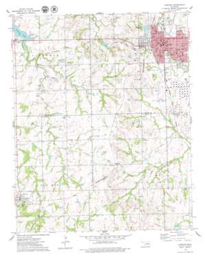
Cushing Topo Map Oklahoma
To zoom in, hover over the map of Cushing
USGS Topo Quad 35096h7 - 1:24,000 scale
| Topo Map Name: | Cushing |
| USGS Topo Quad ID: | 35096h7 |
| Print Size: | ca. 21 1/4" wide x 27" high |
| Southeast Coordinates: | 35.875° N latitude / 96.75° W longitude |
| Map Center Coordinates: | 35.9375° N latitude / 96.8125° W longitude |
| U.S. State: | OK |
| Filename: | o35096h7.jpg |
| Download Map JPG Image: | Cushing topo map 1:24,000 scale |
| Map Type: | Topographic |
| Topo Series: | 7.5´ |
| Map Scale: | 1:24,000 |
| Source of Map Images: | United States Geological Survey (USGS) |
| Alternate Map Versions: |
Cushing OK 1975, updated 1979 Download PDF Buy paper map Cushing OK 2010 Download PDF Buy paper map Cushing OK 2012 Download PDF Buy paper map Cushing OK 2016 Download PDF Buy paper map |
1:24,000 Topo Quads surrounding Cushing
> Back to 35096e1 at 1:100,000 scale
> Back to 35096a1 at 1:250,000 scale
> Back to U.S. Topo Maps home
Cushing topo map: Gazetteer
Cushing: Airports
Cushing Municipal Airport elevation 273m 895′Cushing Regional Hospital Heliport elevation 282m 925′
HSI Heliport elevation 290m 951′
Cushing: Parks
Odum Park elevation 274m 898′Washington Park elevation 270m 885′
Cushing: Populated Places
Agra elevation 314m 1030′Avery elevation 295m 967′
Cushing elevation 285m 935′
Drakes Corner elevation 260m 853′
Soonerville elevation 290m 951′
Wildhorse elevation 314m 1030′
Cushing: Streams
Elm Creek elevation 257m 843′Cushing digital topo map on disk
Buy this Cushing topo map showing relief, roads, GPS coordinates and other geographical features, as a high-resolution digital map file on DVD:


