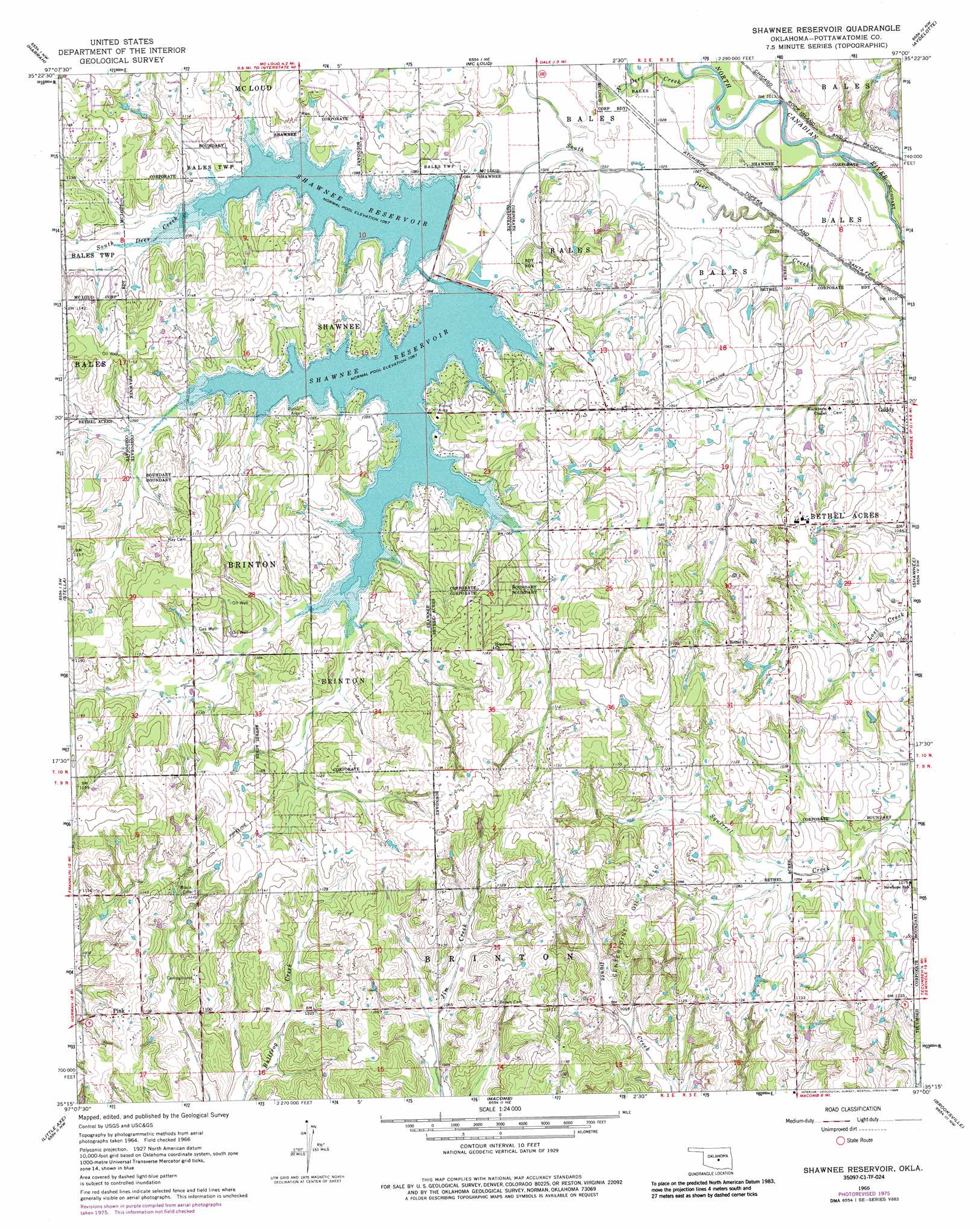
Shawnee Reservoir Topo Map Oklahoma
To zoom in, hover over the map of Shawnee Reservoir
USGS Topo Quad 35097c1 - 1:24,000 scale
| Topo Map Name: | Shawnee Reservoir |
| USGS Topo Quad ID: | 35097c1 |
| Print Size: | ca. 21 1/4" wide x 27" high |
| Southeast Coordinates: | 35.25° N latitude / 97° W longitude |
| Map Center Coordinates: | 35.3125° N latitude / 97.0625° W longitude |
| U.S. State: | OK |
| Filename: | o35097c1.jpg |
| Download Map JPG Image: | Shawnee Reservoir topo map 1:24,000 scale |
| Map Type: | Topographic |
| Topo Series: | 7.5´ |
| Map Scale: | 1:24,000 |
| Source of Map Images: | United States Geological Survey (USGS) |
| Alternate Map Versions: |
Shawnee Reservoir OK 1966, updated 1968 Download PDF Buy paper map Shawnee Reservoir OK 1966, updated 1976 Download PDF Buy paper map Shawnee Reservoir OK 1966, updated 1986 Download PDF Buy paper map Shawnee Reservoir OK 2009 Download PDF Buy paper map Shawnee Reservoir OK 2012 Download PDF Buy paper map Shawnee Reservoir OK 2016 Download PDF Buy paper map |
1:24,000 Topo Quads surrounding Shawnee Reservoir
Jones |
Horseshoe Lake |
Luther Se |
Meeker |
Sparks |
Choctaw |
Harrah |
Mcloud |
Aydelotte |
Shawnee Ne |
Franklin |
Stella |
Shawnee Reservoir |
Shawnee |
Earlsboro |
Denver |
Little Axe |
Macomb |
Brooksville |
Maud |
Purcell |
Eason |
Tribbey |
Pearson |
Saint Louis |
> Back to 35097a1 at 1:100,000 scale
> Back to 35096a1 at 1:250,000 scale
> Back to U.S. Topo Maps home
Shawnee Reservoir topo map: Gazetteer
Shawnee Reservoir: Dams
Longbranch Site 4 Dam elevation 341m 1118′Shawnee City Lake Number 1 Dam elevation 326m 1069′
Shawnee City Lake Number 2 Dam elevation 328m 1076′
Shawnee Reservoir: Oilfields
Centerpoint Oil Field elevation 357m 1171′Shawnee Reservoir: Populated Places
Bethel Acres elevation 343m 1125′Gaddy elevation 329m 1079′
Pink elevation 341m 1118′
Shawnee Reservoir: Reservoirs
Longbranch Site 4 Reservoir elevation 341m 1118′Shawnee City Lake Number 1 elevation 326m 1069′
Shawnee City Lake Number 2 elevation 328m 1076′
Shawnee Reservoir elevation 324m 1062′
Shawnee Reservoir: Streams
North Deer Creek elevation 308m 1010′Shawnee Reservoir digital topo map on disk
Buy this Shawnee Reservoir topo map showing relief, roads, GPS coordinates and other geographical features, as a high-resolution digital map file on DVD: