Union City Topo Map Oklahoma
To zoom in, hover over the map of Union City
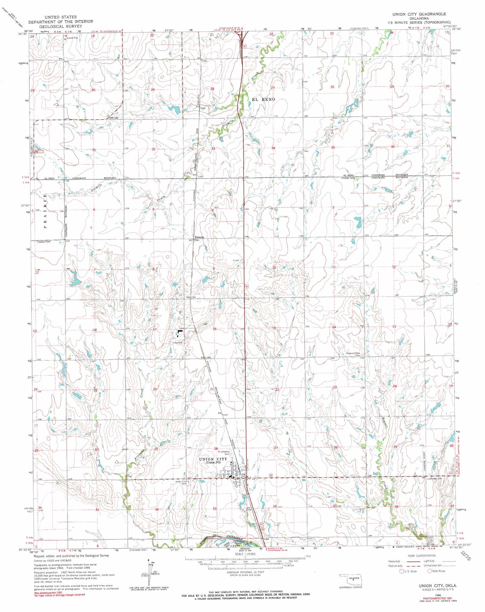
USGS Topo Quad 35097d8 - 1:24,000 scale
| Topo Map Name: | Union City |
| USGS Topo Quad ID: | 35097d8 |
| Print Size: | ca. 21 1/4" wide x 27" high |
| Southeast Coordinates: | 35.375° N latitude / 97.875° W longitude |
| Map Center Coordinates: | 35.4375° N latitude / 97.9375° W longitude |
| U.S. State: | OK |
| Filename: | o35097d8.jpg |
| Download Map JPG Image: | Union City topo map 1:24,000 scale |
| Map Type: | Topographic |
| Topo Series: | 7.5´ |
| Map Scale: | 1:24,000 |
| Source of Map Images: | United States Geological Survey (USGS) |
| Alternate Map Versions: |
Union City OK 1966, updated 1967 Download PDF Buy paper map Union City OK 1966, updated 1991 Download PDF Buy paper map Union City OK 2009 Download PDF Buy paper map Union City OK 2012 Download PDF Buy paper map Union City OK 2016 Download PDF Buy paper map |
1:24,000 Topo Quads surrounding Union City
Porcupine Butte |
Fort Reno Ne |
Okarche |
El Reno Ne |
Piedmont |
Fort Reno Sw |
Fort Reno |
El Reno |
Richland |
Bethany |
Cogar Nw |
Cogar Ne |
Union City |
Minco Ne |
Mustang |
Cogar |
Cogar Se |
Minco |
Tuttle |
Oklahoma City Sw |
Anadarko Nw |
Anadarko Ne |
Pocasset |
Chickasha Ne |
Blanchard |
> Back to 35097a1 at 1:100,000 scale
> Back to 35096a1 at 1:250,000 scale
> Back to U.S. Topo Maps home
Union City topo map: Gazetteer
Union City: Dams
Oknoname 017001 Dam elevation 415m 1361′Union City: Populated Places
Powers elevation 424m 1391′Union City elevation 403m 1322′
Union City: Reservoirs
Oknoname 017001 Reservoir elevation 415m 1361′Union City: Streams
Arapaho Creek elevation 380m 1246′Union City digital topo map on disk
Buy this Union City topo map showing relief, roads, GPS coordinates and other geographical features, as a high-resolution digital map file on DVD: