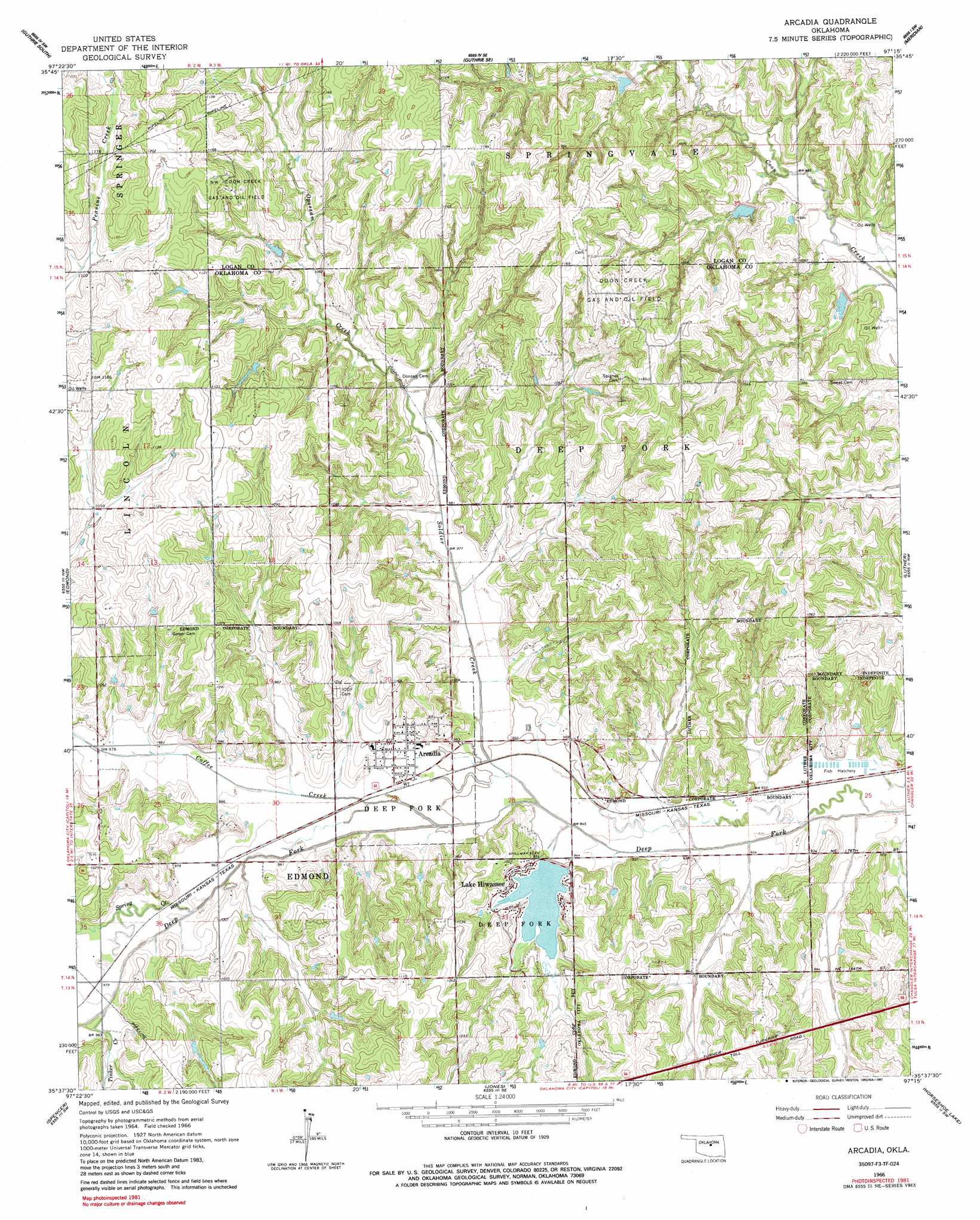
Arcadia Topo Map Oklahoma
To zoom in, hover over the map of Arcadia
USGS Topo Quad 35097f3 - 1:24,000 scale
| Topo Map Name: | Arcadia |
| USGS Topo Quad ID: | 35097f3 |
| Print Size: | ca. 21 1/4" wide x 27" high |
| Southeast Coordinates: | 35.625° N latitude / 97.25° W longitude |
| Map Center Coordinates: | 35.6875° N latitude / 97.3125° W longitude |
| U.S. State: | OK |
| Filename: | o35097f3.jpg |
| Download Map JPG Image: | Arcadia topo map 1:24,000 scale |
| Map Type: | Topographic |
| Topo Series: | 7.5´ |
| Map Scale: | 1:24,000 |
| Source of Map Images: | United States Geological Survey (USGS) |
| Alternate Map Versions: |
Arcadia OK 1966, updated 1967 Download PDF Buy paper map Arcadia OK 1966, updated 1985 Download PDF Buy paper map Arcadia OK 1966, updated 1991 Download PDF Buy paper map Arcadia OK 2010 Download PDF Buy paper map Arcadia OK 2012 Download PDF Buy paper map Arcadia OK 2016 Download PDF Buy paper map |
1:24,000 Topo Quads surrounding Arcadia
Crescent |
Guthrie North |
Langston |
Coyle |
Perkins |
Navina |
Guthrie South |
Guthrie Se |
Meridian |
Carney |
Bethany Ne |
Edmond |
Arcadia |
Luther |
Wellston |
Britton |
Spencer |
Jones |
Horseshoe Lake |
Luther Se |
Oklahoma City |
Midwest City |
Choctaw |
Harrah |
Mcloud |
> Back to 35097e1 at 1:100,000 scale
> Back to 35096a1 at 1:250,000 scale
> Back to U.S. Topo Maps home
Arcadia topo map: Gazetteer
Arcadia: Airports
Woodleaf Aero Estates Airport elevation 345m 1131′Arcadia: Dams
Bear Fall Coon Creek Site 30 Dam elevation 311m 1020′Bear Fall Coon Creek Site 31 Dam elevation 305m 1000′
Bear Fall Coon Creek Site 32 Dam elevation 304m 997′
Hiwassee Lake Dam elevation 297m 974′
Oknoname 083005 Dam elevation 316m 1036′
Oknoname 083006 Dam elevation 342m 1122′
Arcadia: Oilfields
Coon Creek Gas and Oil Field elevation 347m 1138′Northwest Coon Creek Gas and Oil Field elevation 346m 1135′
Arcadia: Populated Places
Arcadia elevation 295m 967′Lake Hiwassee elevation 301m 987′
Arcadia: Reservoirs
Bear Fall Coon Creek Site 30 Reservoir elevation 311m 1020′Bear Fall Coon Creek Site 31 Reservoir elevation 305m 1000′
Bear Fall Coon Creek Site 32 Reservoir elevation 304m 997′
Lake Arcadia elevation 297m 974′
Lake Hiwassee elevation 297m 974′
Oknoname 083005 Reservoir elevation 316m 1036′
Oknoname 083006 Reservoir elevation 342m 1122′
Arcadia: Streams
Coffee Creek elevation 285m 935′Soldier Creek elevation 286m 938′
Spring Creek elevation 291m 954′
Tinker Creek elevation 294m 964′
Arcadia digital topo map on disk
Buy this Arcadia topo map showing relief, roads, GPS coordinates and other geographical features, as a high-resolution digital map file on DVD: