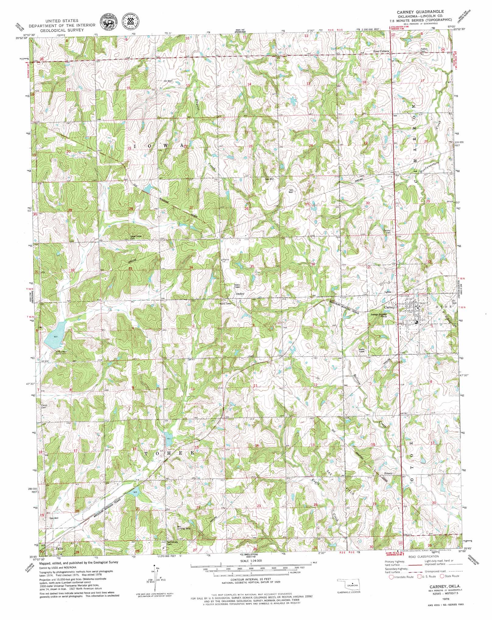
Carney Topo Map Oklahoma
To zoom in, hover over the map of Carney
USGS Topo Quad 35097g1 - 1:24,000 scale
| Topo Map Name: | Carney |
| USGS Topo Quad ID: | 35097g1 |
| Print Size: | ca. 21 1/4" wide x 27" high |
| Southeast Coordinates: | 35.75° N latitude / 97° W longitude |
| Map Center Coordinates: | 35.8125° N latitude / 97.0625° W longitude |
| U.S. State: | OK |
| Filename: | o35097g1.jpg |
| Download Map JPG Image: | Carney topo map 1:24,000 scale |
| Map Type: | Topographic |
| Topo Series: | 7.5´ |
| Map Scale: | 1:24,000 |
| Source of Map Images: | United States Geological Survey (USGS) |
| Alternate Map Versions: |
Carney OK 1978, updated 1979 Download PDF Buy paper map Carney OK 2010 Download PDF Buy paper map Carney OK 2012 Download PDF Buy paper map Carney OK 2016 Download PDF Buy paper map |
1:24,000 Topo Quads surrounding Carney
Clear Creek |
Stillwater Sw |
Stillwater South |
Ripley |
Twin Mounds |
Langston |
Coyle |
Perkins |
Tryon North |
Cushing |
Guthrie Se |
Meridian |
Carney |
Tryon South |
Kendrick |
Arcadia |
Luther |
Wellston |
Chandler |
Davenport |
Jones |
Horseshoe Lake |
Luther Se |
Meeker |
Sparks |
> Back to 35097e1 at 1:100,000 scale
> Back to 35096a1 at 1:250,000 scale
> Back to U.S. Topo Maps home
Carney topo map: Gazetteer
Carney: Airports
Ives Airport elevation 310m 1017′Carney: Dams
Bear Fall Coon Creek Site 2r Dam elevation 285m 935′Bear Fall Coon Creek Site 3r Dam elevation 279m 915′
Oknoname 08106 Dam elevation 281m 921′
Oknoname 08113 Dam elevation 319m 1046′
Carney: Populated Places
Carney elevation 333m 1092′Dudley elevation 342m 1122′
Emsey elevation 306m 1003′
Carney: Reservoirs
Bear Fall Coon Creek Site 2r Reservoir elevation 285m 935′Bear Fall Coon Creek Site 3r Reservoir elevation 279m 915′
Oknoname 08106 Reservoir elevation 281m 921′
Oknoname 08113 Reservoir elevation 319m 1046′
Carney digital topo map on disk
Buy this Carney topo map showing relief, roads, GPS coordinates and other geographical features, as a high-resolution digital map file on DVD: