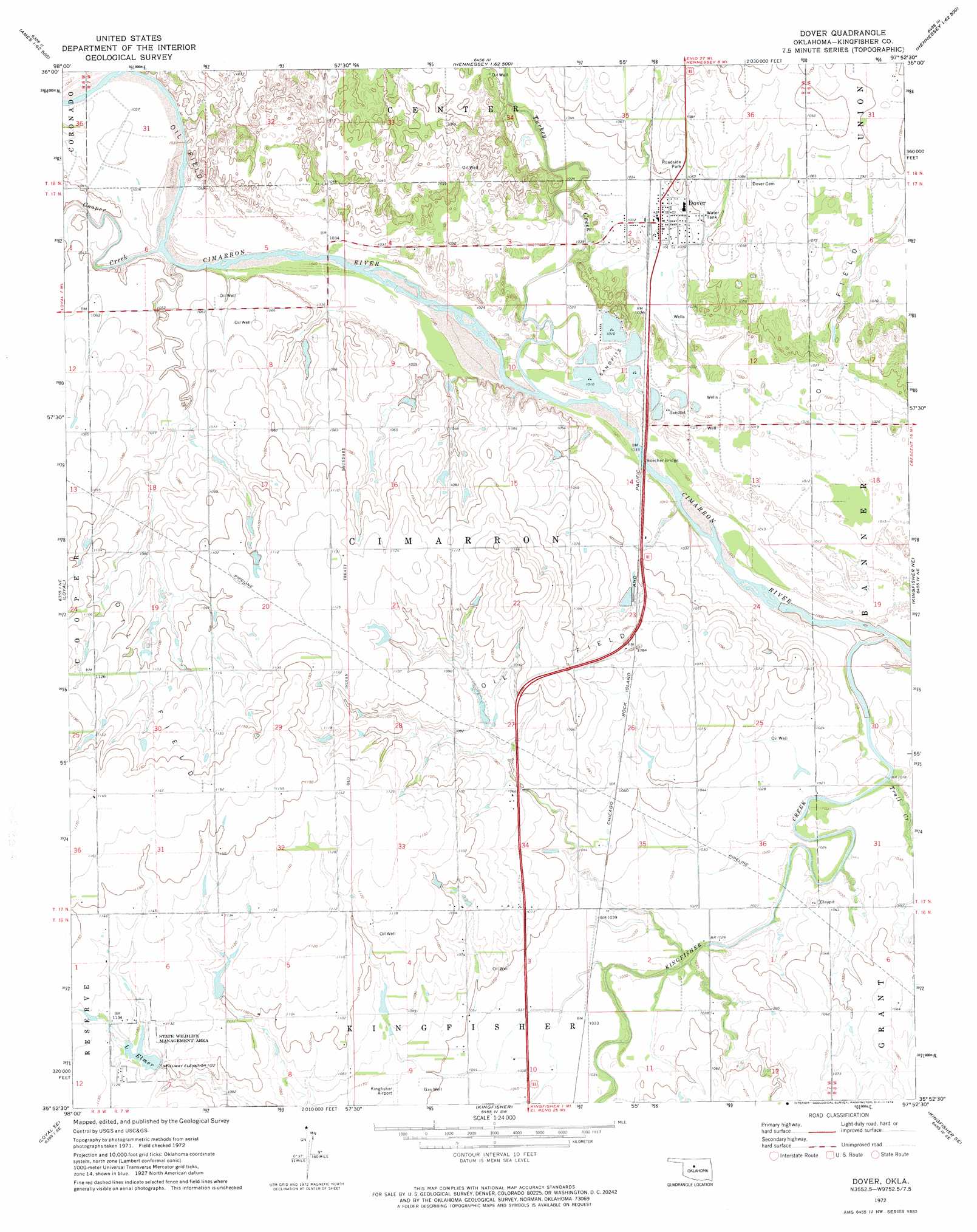
Dover Topo Map Oklahoma
To zoom in, hover over the map of Dover
USGS Topo Quad 35097h8 - 1:24,000 scale
| Topo Map Name: | Dover |
| USGS Topo Quad ID: | 35097h8 |
| Print Size: | ca. 21 1/4" wide x 27" high |
| Southeast Coordinates: | 35.875° N latitude / 97.875° W longitude |
| Map Center Coordinates: | 35.9375° N latitude / 97.9375° W longitude |
| U.S. State: | OK |
| Filename: | o35097h8.jpg |
| Download Map JPG Image: | Dover topo map 1:24,000 scale |
| Map Type: | Topographic |
| Topo Series: | 7.5´ |
| Map Scale: | 1:24,000 |
| Source of Map Images: | United States Geological Survey (USGS) |
| Alternate Map Versions: |
Dover OK 1972, updated 1974 Download PDF Buy paper map Dover OK 2010 Download PDF Buy paper map Dover OK 2012 Download PDF Buy paper map Dover OK 2016 Download PDF Buy paper map |
1:24,000 Topo Quads surrounding Dover
Ames |
Barr |
Bison |
Steinerts Lake |
Marshall West |
Parvin |
Lacey |
Hennessey |
Union |
Lovell |
Loyal Nw |
Loyal |
Dover |
Kingfisher Ne |
Crescent Nw |
Omega |
Loyal Se |
Kingfisher |
Kingfisher Se |
Cashion |
Porcupine Butte |
Fort Reno Ne |
Okarche |
El Reno Ne |
Piedmont |
> Back to 35097e1 at 1:100,000 scale
> Back to 35096a1 at 1:250,000 scale
> Back to U.S. Topo Maps home
Dover topo map: Gazetteer
Dover: Airports
Kingfisher Airport elevation 321m 1053′White Airport elevation 337m 1105′
Dover: Bridges
Boecher Bridge elevation 309m 1013′Dover: Dams
Elmer Lake Dam elevation 337m 1105′Oknoname 07308 Dam elevation 337m 1105′
Oknoname 07312 Dam elevation 329m 1079′
Oknoname 083028 Dam elevation 327m 1072′
Dover: Populated Places
Dover elevation 315m 1033′Dover: Reservoirs
Lake Elmer elevation 342m 1122′Oknoname 07308 Reservoir elevation 337m 1105′
Oknoname 07312 Reservoir elevation 329m 1079′
Oknoname 083028 Reservoir elevation 327m 1072′
Dover: Streams
Cooper Creek elevation 311m 1020′Kingfisher Creek elevation 302m 990′
Lou Anna Creek elevation 315m 1033′
Trail Creek elevation 306m 1003′
Treaty Creek elevation 313m 1026′
Turkey Creek elevation 311m 1020′
Dover digital topo map on disk
Buy this Dover topo map showing relief, roads, GPS coordinates and other geographical features, as a high-resolution digital map file on DVD: