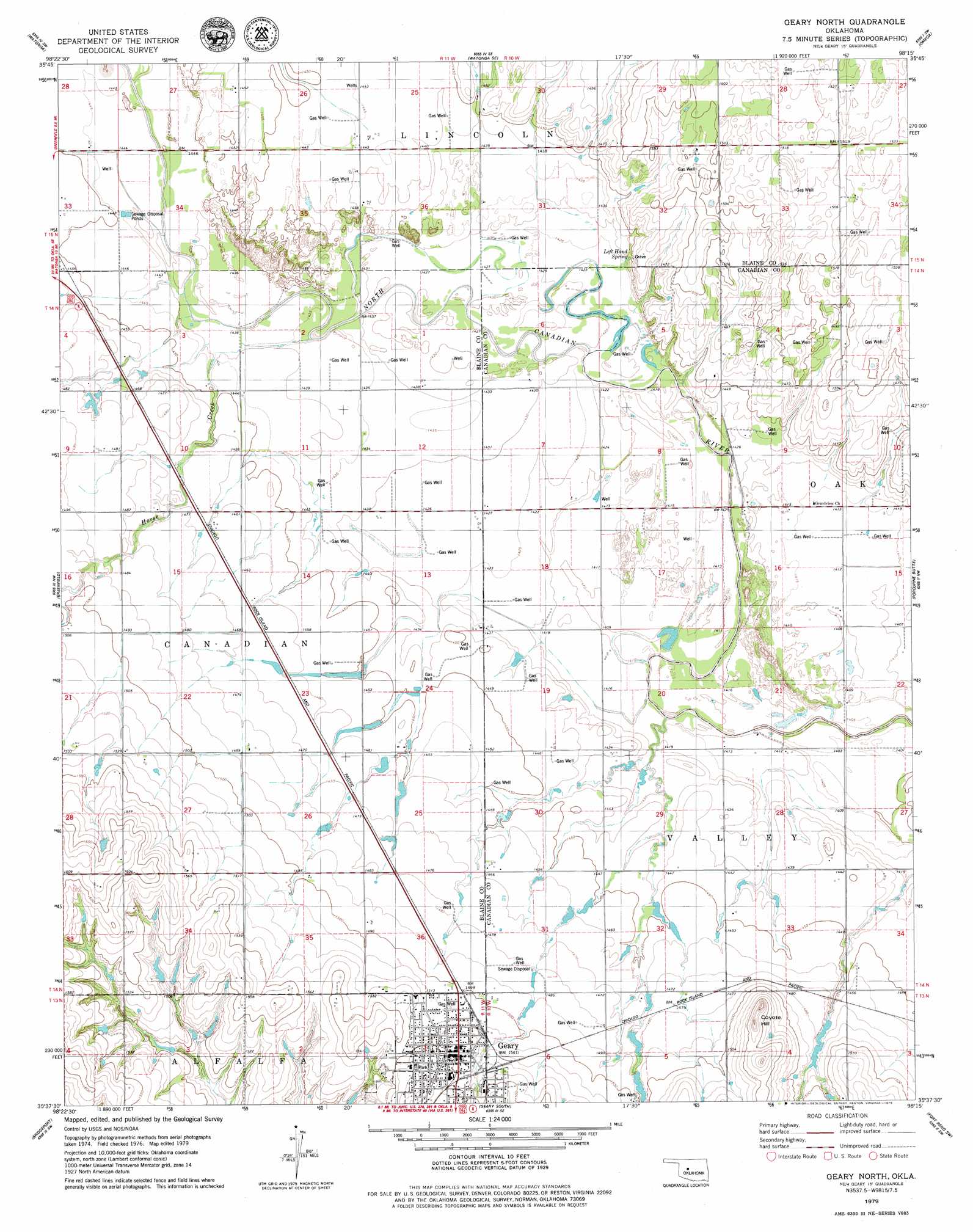
Geary North Topo Map Oklahoma
To zoom in, hover over the map of Geary North
USGS Topo Quad 35098f3 - 1:24,000 scale
| Topo Map Name: | Geary North |
| USGS Topo Quad ID: | 35098f3 |
| Print Size: | ca. 21 1/4" wide x 27" high |
| Southeast Coordinates: | 35.625° N latitude / 98.25° W longitude |
| Map Center Coordinates: | 35.6875° N latitude / 98.3125° W longitude |
| U.S. State: | OK |
| Filename: | o35098f3.jpg |
| Download Map JPG Image: | Geary North topo map 1:24,000 scale |
| Map Type: | Topographic |
| Topo Series: | 7.5´ |
| Map Scale: | 1:24,000 |
| Source of Map Images: | United States Geological Survey (USGS) |
| Alternate Map Versions: |
Geary North OK 1979, updated 1979 Download PDF Buy paper map Geary North OK 2009 Download PDF Buy paper map Geary North OK 2012 Download PDF Buy paper map Geary North OK 2016 Download PDF Buy paper map |
1:24,000 Topo Quads surrounding Geary North
Eagle City |
Watonga Lake |
Hitchcock |
Loyal Nw |
Loyal |
Oakwood Se |
Watonga |
Watonga Se |
Omega |
Loyal Se |
Squaw Creek |
Greenfield |
Geary North |
Porcupine Butte |
Fort Reno Ne |
Hydro |
Bridgeport |
Geary South |
Fort Reno Sw |
Fort Reno |
Eakly Ne |
Rock Mary |
Hinton |
Cogar Nw |
Cogar Ne |
> Back to 35098e1 at 1:100,000 scale
> Back to 35098a1 at 1:250,000 scale
> Back to U.S. Topo Maps home
Geary North topo map: Gazetteer
Geary North: Populated Places
Geary elevation 472m 1548′Geary North: Springs
Left Hand Spring elevation 443m 1453′Geary North: Streams
Horse Creek elevation 436m 1430′Geary North: Summits
Coyote Hill elevation 488m 1601′Geary North digital topo map on disk
Buy this Geary North topo map showing relief, roads, GPS coordinates and other geographical features, as a high-resolution digital map file on DVD: