Erick Topo Map Oklahoma
To zoom in, hover over the map of Erick
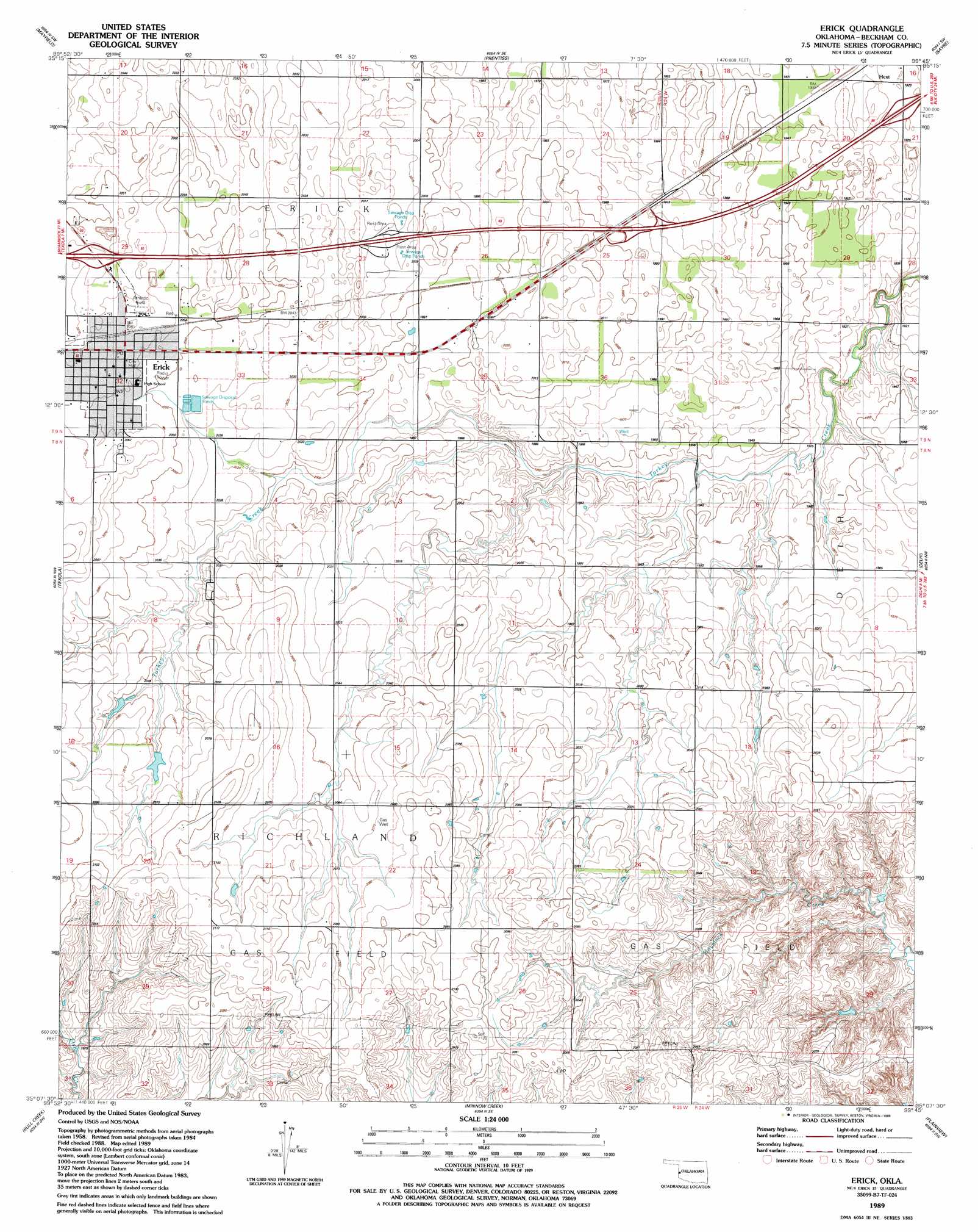
USGS Topo Quad 35099b7 - 1:24,000 scale
| Topo Map Name: | Erick |
| USGS Topo Quad ID: | 35099b7 |
| Print Size: | ca. 21 1/4" wide x 27" high |
| Southeast Coordinates: | 35.125° N latitude / 99.75° W longitude |
| Map Center Coordinates: | 35.1875° N latitude / 99.8125° W longitude |
| U.S. State: | OK |
| Filename: | o35099b7.jpg |
| Download Map JPG Image: | Erick topo map 1:24,000 scale |
| Map Type: | Topographic |
| Topo Series: | 7.5´ |
| Map Scale: | 1:24,000 |
| Source of Map Images: | United States Geological Survey (USGS) |
| Alternate Map Versions: |
Erick OK 1989, updated 1989 Download PDF Buy paper map Erick OK 2010 Download PDF Buy paper map Erick OK 2012 Download PDF Buy paper map Erick OK 2016 Download PDF Buy paper map |
1:24,000 Topo Quads surrounding Erick
Kelton |
Sweetwater |
Grimes |
Berlin |
Baker Lake |
Kelton Se |
Mayfield |
Prentiss |
Sayre |
Doxey |
Fuller |
Texola |
Erick |
Dehli |
Carter West |
Little Wolf Creek |
Bull Creek |
Minnow Creek |
Plainview |
Willow |
Shinnery Creek |
Madge |
Vinson |
Reed |
Mangum North |
> Back to 35099a1 at 1:100,000 scale
> Back to 35098a1 at 1:250,000 scale
> Back to U.S. Topo Maps home
Erick digital topo map on disk
Buy this Erick topo map showing relief, roads, GPS coordinates and other geographical features, as a high-resolution digital map file on DVD: