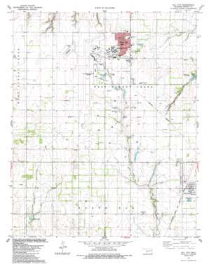
Dill City Topo Map Oklahoma
To zoom in, hover over the map of Dill City
USGS Topo Quad 35099c2 - 1:24,000 scale
| Topo Map Name: | Dill City |
| USGS Topo Quad ID: | 35099c2 |
| Print Size: | ca. 21 1/4" wide x 27" high |
| Southeast Coordinates: | 35.25° N latitude / 99.125° W longitude |
| Map Center Coordinates: | 35.3125° N latitude / 99.1875° W longitude |
| U.S. State: | OK |
| Filename: | o35099c2.jpg |
| Download Map JPG Image: | Dill City topo map 1:24,000 scale |
| Map Type: | Topographic |
| Topo Series: | 7.5´ |
| Map Scale: | 1:24,000 |
| Source of Map Images: | United States Geological Survey (USGS) |
| Alternate Map Versions: |
Dill City OK 1983, updated 1984 Download PDF Buy paper map Dill City OK 1983, updated 1989 Download PDF Buy paper map Dill City OK 2010 Download PDF Buy paper map Dill City OK 2012 Download PDF Buy paper map Dill City OK 2016 Download PDF Buy paper map |
1:24,000 Topo Quads surrounding Dill City
> Back to 35099a1 at 1:100,000 scale
> Back to 35098a1 at 1:250,000 scale
> Back to U.S. Topo Maps home
Dill City topo map: Gazetteer
Dill City: Airports
Clinton-Sherman Airport elevation 581m 1906′Clinton-Sherman Airport elevation 582m 1909′
Dill City: Dams
Clinton-Sherman Reservoir Dam elevation 577m 1893′Cordell Reservoir Dam elevation 526m 1725′
Oknoname 149030 Dam elevation 574m 1883′
Oknoname 149032 Dam elevation 557m 1827′
Dill City: Parks
Adams Lake City Park elevation 524m 1719′Arrowhead Park elevation 578m 1896′
Dill City: Populated Places
Burns Flat elevation 578m 1896′Dill City elevation 565m 1853′
Dill City: Reservoirs
Adams Lake elevation 527m 1729′Clinton-Sherman Reservoir Reservoir elevation 577m 1893′
Cordell Reservoir elevation 526m 1725′
Crystal Lake elevation 530m 1738′
Oknoname 149030 Reservoir elevation 574m 1883′
Oknoname 149032 Reservoir elevation 557m 1827′
Dill City digital topo map on disk
Buy this Dill City topo map showing relief, roads, GPS coordinates and other geographical features, as a high-resolution digital map file on DVD:


