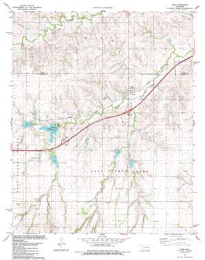
Foss Topo Map Oklahoma
To zoom in, hover over the map of Foss
USGS Topo Quad 35099d2 - 1:24,000 scale
| Topo Map Name: | Foss |
| USGS Topo Quad ID: | 35099d2 |
| Print Size: | ca. 21 1/4" wide x 27" high |
| Southeast Coordinates: | 35.375° N latitude / 99.125° W longitude |
| Map Center Coordinates: | 35.4375° N latitude / 99.1875° W longitude |
| U.S. State: | OK |
| Filename: | o35099d2.jpg |
| Download Map JPG Image: | Foss topo map 1:24,000 scale |
| Map Type: | Topographic |
| Topo Series: | 7.5´ |
| Map Scale: | 1:24,000 |
| Source of Map Images: | United States Geological Survey (USGS) |
| Alternate Map Versions: |
Foss OK 1983, updated 1984 Download PDF Buy paper map Foss OK 2010 Download PDF Buy paper map Foss OK 2012 Download PDF Buy paper map Foss OK 2016 Download PDF Buy paper map |
1:24,000 Topo Quads surrounding Foss
> Back to 35099a1 at 1:100,000 scale
> Back to 35098a1 at 1:250,000 scale
> Back to U.S. Topo Maps home
Foss topo map: Gazetteer
Foss: Dams
Clinton Dam elevation 534m 1751′Ronald Sewell Dam elevation 516m 1692′
Soldier Creek Watershed Site 1 Dam elevation 508m 1666′
Soldier Creek Watershed Site 11 Dam elevation 529m 1735′
Soldier Creek Watershed Site 2 Dam elevation 531m 1742′
Soldier Creek Watershed Site 6 Dam elevation 528m 1732′
Soldier Creek Watershed Site 7 Dam elevation 517m 1696′
Turkey Creek Site 1 Dam elevation 485m 1591′
Turkey Creek Site 10 Dam elevation 514m 1686′
Turkey Creek Site 11 Dam elevation 503m 1650′
Turkey Creek Site 12 Dam elevation 497m 1630′
Turkey Creek Site 2 Dam elevation 502m 1646′
Turkey Creek Site 3 Dam elevation 516m 1692′
Turkey Creek Site 4 Dam elevation 509m 1669′
Turkey Creek Site 5 Dam elevation 540m 1771′
Turkey Creek Site 6 Dam elevation 533m 1748′
Turkey Creek Site 7 Dam elevation 534m 1751′
Turkey Creek Site 8 Dam elevation 512m 1679′
Turkey Creek Site 9 Dam elevation 516m 1692′
Foss: Populated Places
Foss elevation 500m 1640′Foss: Reservoirs
Clinton Lake elevation 534m 1751′Clinton Lake elevation 521m 1709′
Ronald Sewell Reservoir elevation 516m 1692′
Soldier Creek Watershed Site 1 Reservoir elevation 508m 1666′
Soldier Creek Watershed Site 11 Reservoir elevation 529m 1735′
Soldier Creek Watershed Site 2 Reservoir elevation 531m 1742′
Soldier Creek Watershed Site 6 Reservoir elevation 528m 1732′
Soldier Creek Watershed Site 7 Reservoir elevation 517m 1696′
Turkey Creek Site 1 Reservoir elevation 485m 1591′
Turkey Creek Site 10 Reservoir elevation 514m 1686′
Turkey Creek Site 11 Reservoir elevation 503m 1650′
Turkey Creek Site 12 Reservoir elevation 497m 1630′
Turkey Creek Site 2 Reservoir elevation 502m 1646′
Turkey Creek Site 3 Reservoir elevation 516m 1692′
Turkey Creek Site 4 Reservoir elevation 509m 1669′
Turkey Creek Site 5 Reservoir elevation 540m 1771′
Turkey Creek Site 6 Reservoir elevation 533m 1748′
Turkey Creek Site 7 Reservoir elevation 534m 1751′
Turkey Creek Site 8 Reservoir elevation 512m 1679′
Turkey Creek Site 9 Reservoir elevation 516m 1692′
Foss: Streams
Monument Creek elevation 527m 1729′Sand Creek elevation 490m 1607′
Foss digital topo map on disk
Buy this Foss topo map showing relief, roads, GPS coordinates and other geographical features, as a high-resolution digital map file on DVD:


