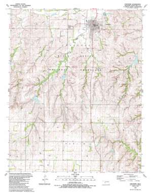
Cheyenne Topo Map Oklahoma
To zoom in, hover over the map of Cheyenne
USGS Topo Quad 35099e6 - 1:24,000 scale
| Topo Map Name: | Cheyenne |
| USGS Topo Quad ID: | 35099e6 |
| Print Size: | ca. 21 1/4" wide x 27" high |
| Southeast Coordinates: | 35.5° N latitude / 99.625° W longitude |
| Map Center Coordinates: | 35.5625° N latitude / 99.6875° W longitude |
| U.S. State: | OK |
| Filename: | o35099e6.jpg |
| Download Map JPG Image: | Cheyenne topo map 1:24,000 scale |
| Map Type: | Topographic |
| Topo Series: | 7.5´ |
| Map Scale: | 1:24,000 |
| Source of Map Images: | United States Geological Survey (USGS) |
| Alternate Map Versions: |
Cheyenne OK 1989, updated 1989 Download PDF Buy paper map Cheyenne OK 1998, updated 2001 Download PDF Buy paper map Cheyenne OK 2011 Download PDF Buy paper map Cheyenne OK 2012 Download PDF Buy paper map Cheyenne OK 2016 Download PDF Buy paper map |
| FStopo: | US Forest Service topo Cheyenne is available: Download FStopo PDF Download FStopo TIF |
1:24,000 Topo Quads surrounding Cheyenne
> Back to 35099e1 at 1:100,000 scale
> Back to 35098a1 at 1:250,000 scale
> Back to U.S. Topo Maps home
Cheyenne topo map: Gazetteer
Cheyenne: Airports
L J Pankey Heliport elevation 602m 1975′Mignon Laird Municipal Airport elevation 629m 2063′
Cheyenne: Dams
Beaty Dam elevation 616m 2020′Beaver Dam Creek Site 3 elevation 586m 1922′
Broken Leg Creek Site 1 Dam elevation 634m 2080′
Sandstone Creek Site 113 Dam elevation 660m 2165′
Sandstone Creek Site 114 Dam elevation 676m 2217′
Sandstone Creek Site 115 Dam elevation 678m 2224′
Sargeant Major Creek Site 1 Dam elevation 626m 2053′
Sargeant Major Creek Site 2 Dam elevation 616m 2020′
Sargeant Major Creek Site 3 Dam elevation 627m 2057′
Sargeant Major Creek Site 4 Dam elevation 656m 2152′
Sargeant Major Creek Site 5 Dam elevation 631m 2070′
Sargeant Major Creek Site 6 Dam elevation 606m 1988′
Sprowles Number 1 Dam elevation 655m 2148′
Sprowles Number 3 Dam elevation 624m 2047′
Cheyenne: Parks
Memorial Park elevation 603m 1978′Washita Battlefield National Historic Site elevation 608m 1994′
Cheyenne: Populated Places
Cheyenne elevation 601m 1971′Rosehill elevation 716m 2349′
Cheyenne: Reservoirs
Beaty Reservoir elevation 616m 2020′Beaver Dam Creek Site 3 elevation 586m 1922′
Broken Leg Creek Site 1 Reservoir elevation 634m 2080′
Sandstone Creek Site 113 Reservoir elevation 660m 2165′
Sandstone Creek Site 114 Reservoir elevation 676m 2217′
Sandstone Creek Site 115 Reservoir elevation 678m 2224′
Sargeant Major Creek Site 1 Reservoir elevation 626m 2053′
Sargeant Major Creek Site 2 Reservoir elevation 616m 2020′
Sargeant Major Creek Site 3 Reservoir elevation 627m 2057′
Sargeant Major Creek Site 4 Reservoir elevation 656m 2152′
Sargeant Major Creek Site 5 Reservoir elevation 631m 2070′
Sargeant Major Creek Site 6 Reservoir elevation 606m 1988′
Sprowles Number 1 Reservoir elevation 655m 2148′
Sprowles Number 3 Reservoir elevation 624m 2047′
Cheyenne: Streams
Brokenleg Creek elevation 594m 1948′Dry Creek elevation 592m 1942′
East Fork Sergeant Major Creek elevation 604m 1981′
Plum Creek elevation 592m 1942′
Cheyenne digital topo map on disk
Buy this Cheyenne topo map showing relief, roads, GPS coordinates and other geographical features, as a high-resolution digital map file on DVD:


