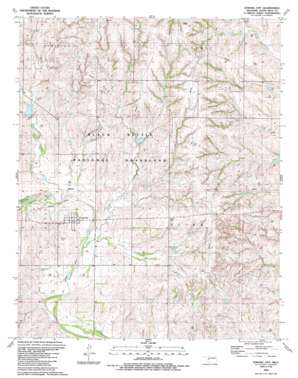
Strong City Topo Map Oklahoma
To zoom in, hover over the map of Strong City
USGS Topo Quad 35099f5 - 1:24,000 scale
| Topo Map Name: | Strong City |
| USGS Topo Quad ID: | 35099f5 |
| Print Size: | ca. 21 1/4" wide x 27" high |
| Southeast Coordinates: | 35.625° N latitude / 99.5° W longitude |
| Map Center Coordinates: | 35.6875° N latitude / 99.5625° W longitude |
| U.S. State: | OK |
| Filename: | o35099f5.jpg |
| Download Map JPG Image: | Strong City topo map 1:24,000 scale |
| Map Type: | Topographic |
| Topo Series: | 7.5´ |
| Map Scale: | 1:24,000 |
| Source of Map Images: | United States Geological Survey (USGS) |
| Alternate Map Versions: |
Strong City OK 1989, updated 1989 Download PDF Buy paper map Strong City OK 1998, updated 2001 Download PDF Buy paper map Strong City OK 2011 Download PDF Buy paper map Strong City OK 2012 Download PDF Buy paper map Strong City OK 2016 Download PDF Buy paper map |
| FStopo: | US Forest Service topo Strong City is available: Download FStopo PDF Download FStopo TIF |
1:24,000 Topo Quads surrounding Strong City
> Back to 35099e1 at 1:100,000 scale
> Back to 35098a1 at 1:250,000 scale
> Back to U.S. Topo Maps home
Strong City topo map: Gazetteer
Strong City: Dams
C Wickham Number 1 Dam elevation 630m 2066′Dead Indian-Wildhorse Site 1 Dam elevation 580m 1902′
Dead Indian-Wildhorse Site 2 Dam elevation 598m 1961′
Nine Mile Creek Site 1 Dam elevation 592m 1942′
Nine Mile Creek Site 13 Dam elevation 570m 1870′
Nine Mile Creek Site 14 Dam elevation 582m 1909′
Nine Mile Creek Site 15 Dam elevation 580m 1902′
Nine Mile Creek Site 2 Dam elevation 607m 1991′
Nine Mile Creek Site 4 Dam elevation 602m 1975′
Nine Mile Creek Site 5 Dam elevation 578m 1896′
Nine Mile Creek Site 6 Dam elevation 595m 1952′
Quartermaster Site 7 Dam elevation 634m 2080′
Quartermaster Site 8 Dam elevation 598m 1961′
Quartermaster Site 9 Dam elevation 597m 1958′
R Wickham Number 3 Dam elevation 632m 2073′
Strong City: Populated Places
Strong City elevation 574m 1883′Strong City: Reservoirs
C Wickham Number 1 Reservoir elevation 630m 2066′Dead Indian-Wildhorse Site 1 Reservoir elevation 580m 1902′
Dead Indian-Wildhorse Site 2 Reservoir elevation 598m 1961′
Mine Mile Creek Site 14 Reservoir elevation 582m 1909′
Nine Mile Creek Site 1 Reservoir elevation 592m 1942′
Nine Mile Creek Site 13 Reservoir elevation 570m 1870′
Nine Mile Creek Site 15 Reservoir elevation 580m 1902′
Nine Mile Creek Site 2 Reservoir elevation 607m 1991′
Nine Mile Creek Site 4 Reservoir elevation 602m 1975′
Nine Mile Creek Site 5 Reservoir elevation 578m 1896′
Nine Mile Creek Site 6 Reservoir elevation 595m 1952′
Quartermaster Site 7 Reservoir elevation 634m 2080′
Quartermaster Site 8 Reservoir elevation 598m 1961′
Quartermaster Site 9 Reservoir elevation 597m 1958′
R Wickham Number 3 Reservoir elevation 632m 2073′
Strong City: Streams
Caffey Creek elevation 558m 1830′Cofer Creek elevation 561m 1840′
Dead Warrior Creek elevation 567m 1860′
Wild Horse Creek elevation 565m 1853′
Strong City digital topo map on disk
Buy this Strong City topo map showing relief, roads, GPS coordinates and other geographical features, as a high-resolution digital map file on DVD:


