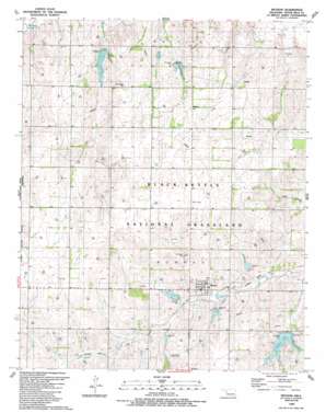
Reydon Topo Map Oklahoma
To zoom in, hover over the map of Reydon
USGS Topo Quad 35099f8 - 1:24,000 scale
| Topo Map Name: | Reydon |
| USGS Topo Quad ID: | 35099f8 |
| Print Size: | ca. 21 1/4" wide x 27" high |
| Southeast Coordinates: | 35.625° N latitude / 99.875° W longitude |
| Map Center Coordinates: | 35.6875° N latitude / 99.9375° W longitude |
| U.S. State: | OK |
| Filename: | o35099f8.jpg |
| Download Map JPG Image: | Reydon topo map 1:24,000 scale |
| Map Type: | Topographic |
| Topo Series: | 7.5´ |
| Map Scale: | 1:24,000 |
| Source of Map Images: | United States Geological Survey (USGS) |
| Alternate Map Versions: |
Reydon OK 1989, updated 1989 Download PDF Buy paper map Reydon OK 1998, updated 2001 Download PDF Buy paper map Reydon OK 2011 Download PDF Buy paper map Reydon OK 2012 Download PDF Buy paper map Reydon OK 2016 Download PDF Buy paper map |
| FStopo: | US Forest Service topo Reydon is available: Download FStopo PDF Download FStopo TIF |
1:24,000 Topo Quads surrounding Reydon
> Back to 35099e1 at 1:100,000 scale
> Back to 35098a1 at 1:250,000 scale
> Back to U.S. Topo Maps home
Reydon topo map: Gazetteer
Reydon: Airports
Cary Ranch Airport elevation 743m 2437′Cary Ranch Landing Strip elevation 745m 2444′
Reydon: Dams
Upper Washita River Site 101 Dam elevation 703m 2306′Upper Washita River Site 49 Dam elevation 718m 2355′
Upper Washita River Site 50 Dam elevation 724m 2375′
Upper Washita Site 35 Dam elevation 683m 2240′
Upper Washita Site 36 Dam elevation 703m 2306′
Upper Washita Site 41 Dam elevation 672m 2204′
Upper Washita Site 48 Dam elevation 720m 2362′
Upper Washita Site 51 Dam elevation 710m 2329′
Upper Washita Site 52 Dam elevation 682m 2237′
Upper Washita Site 53 Dam elevation 688m 2257′
Upper Washita Site 56 Dam elevation 748m 2454′
Reydon: Populated Places
Reydon elevation 696m 2283′Reydon: Reservoirs
Skipout Lake elevation 688m 2257′Upper Washita River Site 49 Reservoir elevation 718m 2355′
Upper Washita River Site 50 Reservoir elevation 724m 2375′
Upper Washita Site 101 Reservoir elevation 703m 2306′
Upper Washita Site 35 Reservoir elevation 683m 2240′
Upper Washita Site 36 Reservoir elevation 703m 2306′
Upper Washita Site 41 Reservoir elevation 672m 2204′
Upper Washita Site 48 Reservoir elevation 720m 2362′
Upper Washita Site 51 Reservoir elevation 710m 2329′
Upper Washita Site 52 Reservoir elevation 682m 2237′
Upper Washita Site 53 Reservoir elevation 688m 2257′
Upper Washita Site 56 Reservoir elevation 748m 2454′
Reydon digital topo map on disk
Buy this Reydon topo map showing relief, roads, GPS coordinates and other geographical features, as a high-resolution digital map file on DVD:


