Little Wolf Creek Topo Map Texas
To zoom in, hover over the map of Little Wolf Creek
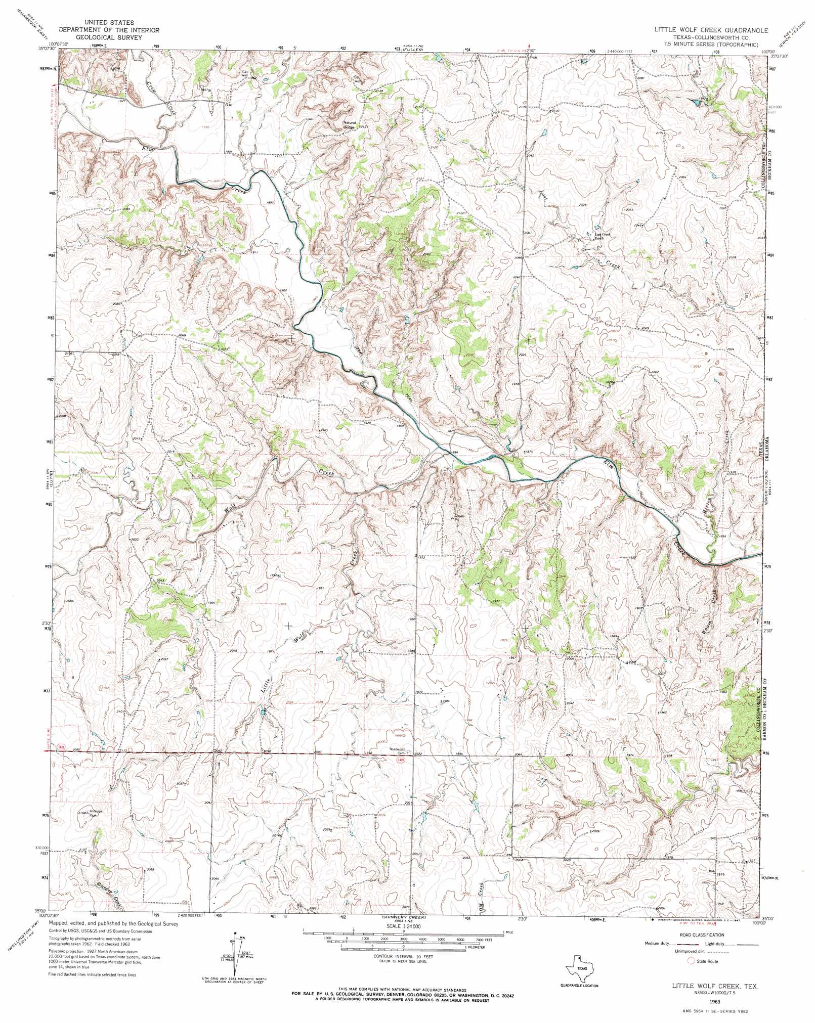
USGS Topo Quad 35100a1 - 1:24,000 scale
| Topo Map Name: | Little Wolf Creek |
| USGS Topo Quad ID: | 35100a1 |
| Print Size: | ca. 21 1/4" wide x 27" high |
| Southeast Coordinates: | 35° N latitude / 100° W longitude |
| Map Center Coordinates: | 35.0625° N latitude / 100.0625° W longitude |
| U.S. State: | TX |
| Filename: | o35100a1.jpg |
| Download Map JPG Image: | Little Wolf Creek topo map 1:24,000 scale |
| Map Type: | Topographic |
| Topo Series: | 7.5´ |
| Map Scale: | 1:24,000 |
| Source of Map Images: | United States Geological Survey (USGS) |
| Alternate Map Versions: |
Little Wolf Creek TX 1963, updated 1967 Download PDF Buy paper map Little Wolf Creek TX 2010 Download PDF Buy paper map Little Wolf Creek TX 2012 Download PDF Buy paper map Little Wolf Creek TX 2016 Download PDF Buy paper map |
1:24,000 Topo Quads surrounding Little Wolf Creek
Wheeler Se |
Twitty |
Kelton Se |
Mayfield |
Prentiss |
Shamrock West |
Shamrock East |
Fuller |
Texola |
Erick |
Dozier |
Lutie |
Little Wolf Creek |
Bull Creek |
Minnow Creek |
Rolla Ne |
Wellington Nw |
Shinnery Creek |
Madge |
Vinson |
Rolla |
Wellington |
Dodson |
Mcknight |
Shrewder |
> Back to 35100a1 at 1:100,000 scale
> Back to 35100a1 at 1:250,000 scale
> Back to U.S. Topo Maps home
Little Wolf Creek topo map: Gazetteer
Little Wolf Creek: Arches
Natural Bridge elevation 633m 2076′Little Wolf Creek: Streams
Crow Creek elevation 578m 1896′Hinton Creek elevation 550m 1804′
Little Wolf Creek elevation 565m 1853′
Lost Creek elevation 593m 1945′
Wagon Creek elevation 550m 1804′
Wolf Creek elevation 560m 1837′
Little Wolf Creek digital topo map on disk
Buy this Little Wolf Creek topo map showing relief, roads, GPS coordinates and other geographical features, as a high-resolution digital map file on DVD: