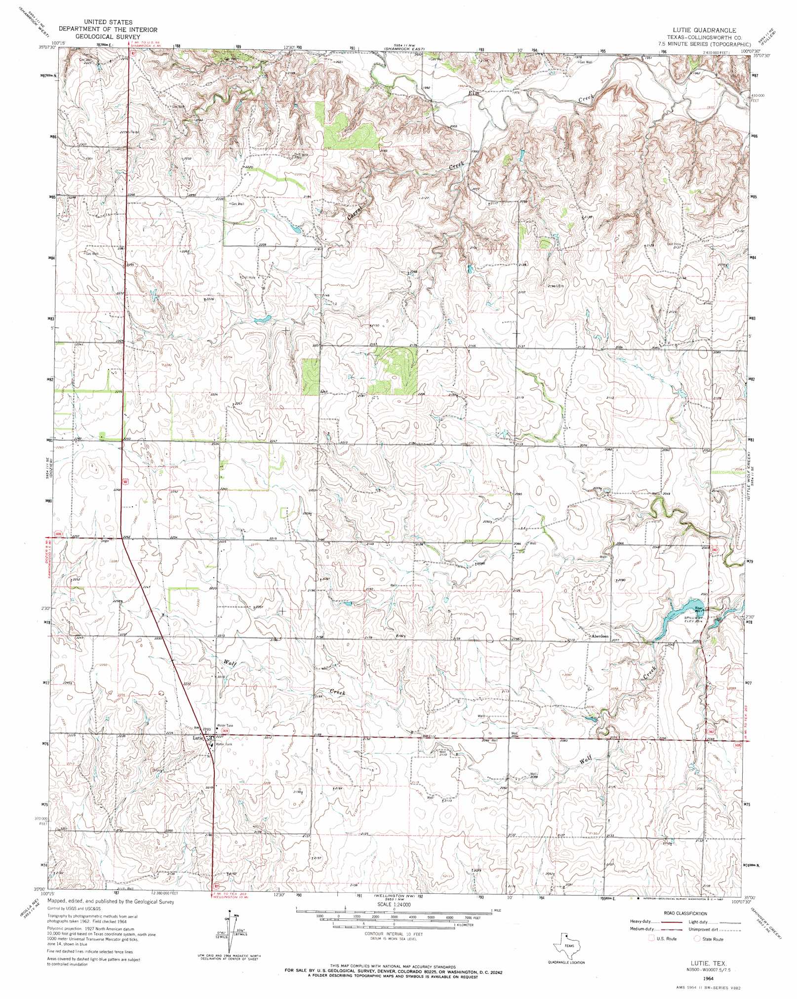
Lutie Topo Map Texas
To zoom in, hover over the map of Lutie
USGS Topo Quad 35100a2 - 1:24,000 scale
| Topo Map Name: | Lutie |
| USGS Topo Quad ID: | 35100a2 |
| Print Size: | ca. 21 1/4" wide x 27" high |
| Southeast Coordinates: | 35° N latitude / 100.125° W longitude |
| Map Center Coordinates: | 35.0625° N latitude / 100.1875° W longitude |
| U.S. State: | TX |
| Filename: | o35100a2.jpg |
| Download Map JPG Image: | Lutie topo map 1:24,000 scale |
| Map Type: | Topographic |
| Topo Series: | 7.5´ |
| Map Scale: | 1:24,000 |
| Source of Map Images: | United States Geological Survey (USGS) |
| Alternate Map Versions: |
Lutie TX 1964, updated 1967 Download PDF Buy paper map Lutie TX 2010 Download PDF Buy paper map Lutie TX 2012 Download PDF Buy paper map Lutie TX 2016 Download PDF Buy paper map |
1:24,000 Topo Quads surrounding Lutie
Pakan |
Wheeler Se |
Twitty |
Kelton Se |
Mayfield |
Ramsdell |
Shamrock West |
Shamrock East |
Fuller |
Texola |
Abra |
Dozier |
Lutie |
Little Wolf Creek |
Bull Creek |
Quail |
Rolla Ne |
Wellington Nw |
Shinnery Creek |
Madge |
Rolla Sw |
Rolla |
Wellington |
Dodson |
Mcknight |
> Back to 35100a1 at 1:100,000 scale
> Back to 35100a1 at 1:250,000 scale
> Back to U.S. Topo Maps home
Lutie topo map: Gazetteer
Lutie: Populated Places
Aberdeen elevation 632m 2073′Lutie elevation 680m 2230′
Lutie: Springs
Wolf Creek Springs elevation 617m 2024′Lutie: Streams
Corral Creek elevation 599m 1965′Raven Creek elevation 590m 1935′
Lutie digital topo map on disk
Buy this Lutie topo map showing relief, roads, GPS coordinates and other geographical features, as a high-resolution digital map file on DVD: