Jericho Topo Map Texas
To zoom in, hover over the map of Jericho
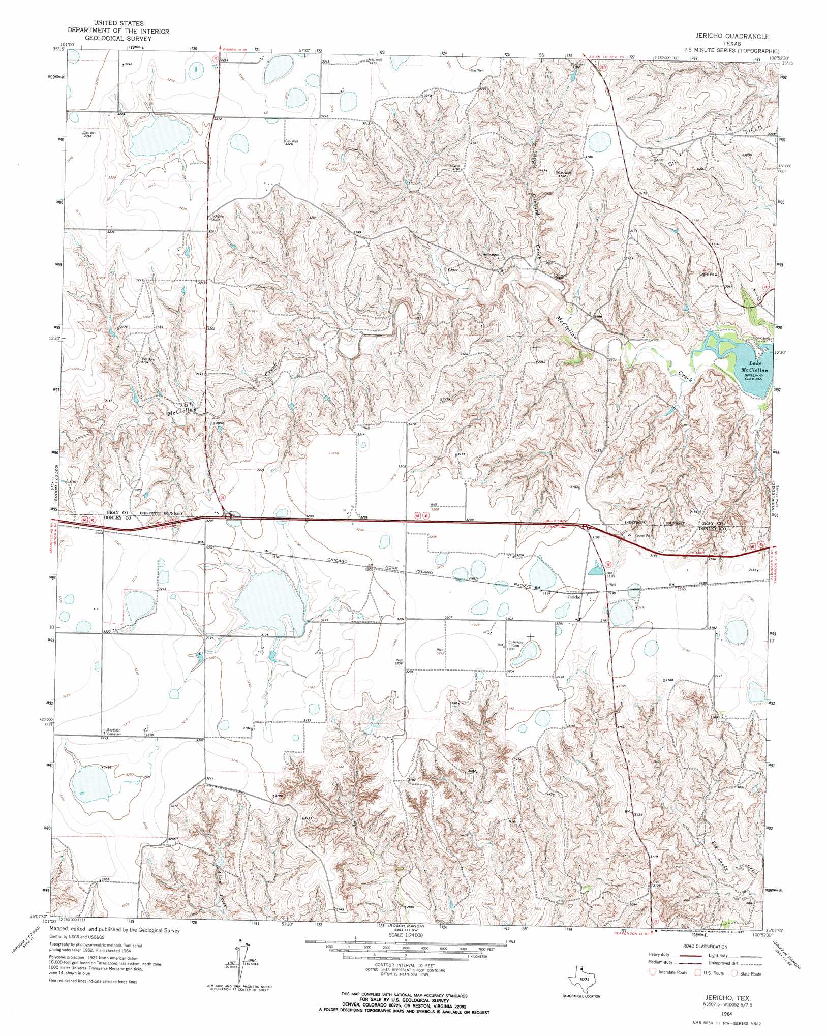
USGS Topo Quad 35100b8 - 1:24,000 scale
| Topo Map Name: | Jericho |
| USGS Topo Quad ID: | 35100b8 |
| Print Size: | ca. 21 1/4" wide x 27" high |
| Southeast Coordinates: | 35.125° N latitude / 100.875° W longitude |
| Map Center Coordinates: | 35.1875° N latitude / 100.9375° W longitude |
| U.S. State: | TX |
| Filename: | o35100b8.jpg |
| Download Map JPG Image: | Jericho topo map 1:24,000 scale |
| Map Type: | Topographic |
| Topo Series: | 7.5´ |
| Map Scale: | 1:24,000 |
| Source of Map Images: | United States Geological Survey (USGS) |
| Alternate Map Versions: |
Jericho TX 1964, updated 1967 Download PDF Buy paper map Jericho TX 1998, updated 2001 Download PDF Buy paper map Jericho TX 2010 Download PDF Buy paper map Jericho TX 2012 Download PDF Buy paper map Jericho TX 2016 Download PDF Buy paper map |
| FStopo: | US Forest Service topo Jericho is available: Download FStopo PDF Download FStopo TIF |
1:24,000 Topo Quads surrounding Jericho
White Deer |
Kingsmill |
Bowers City |
Lefors |
Pond Creek Nw |
White Deer Sw |
Grandview School |
Deep Lake |
Taylor Ranch |
Hudgens Ranch |
Lark |
Groom |
Jericho |
Rockledge |
Alanreed |
Goodnight |
Ashtola |
Roach Ranch |
Griffin Ranch |
Troublesome Creek |
Blue Hole Springs |
Buffalo Arroyo |
Clarendon |
Lelia Lake |
Lelia Lake Creek |
> Back to 35100a1 at 1:100,000 scale
> Back to 35100a1 at 1:250,000 scale
> Back to U.S. Topo Maps home
Jericho topo map: Gazetteer
Jericho: Populated Places
Jericho elevation 976m 3202′Jericho: Streams
Apple Orchard Creek elevation 905m 2969′Jericho digital topo map on disk
Buy this Jericho topo map showing relief, roads, GPS coordinates and other geographical features, as a high-resolution digital map file on DVD: