Spring Creek Topo Map Texas
To zoom in, hover over the map of Spring Creek
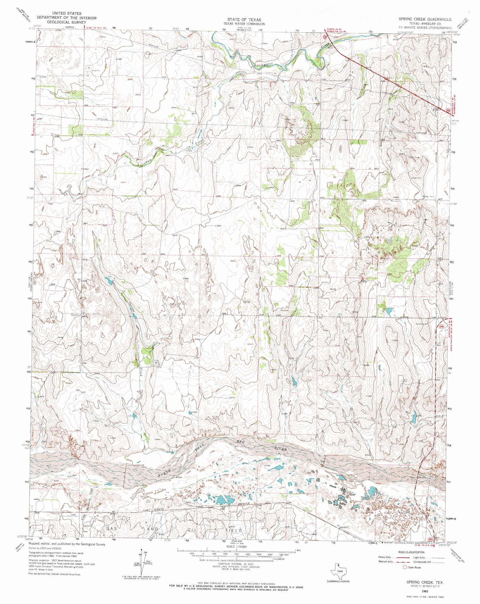
USGS Topo Quad 35100d4 - 1:24,000 scale
| Topo Map Name: | Spring Creek |
| USGS Topo Quad ID: | 35100d4 |
| Print Size: | ca. 21 1/4" wide x 27" high |
| Southeast Coordinates: | 35.375° N latitude / 100.375° W longitude |
| Map Center Coordinates: | 35.4375° N latitude / 100.4375° W longitude |
| U.S. State: | TX |
| Filename: | o35100d4.jpg |
| Download Map JPG Image: | Spring Creek topo map 1:24,000 scale |
| Map Type: | Topographic |
| Topo Series: | 7.5´ |
| Map Scale: | 1:24,000 |
| Source of Map Images: | United States Geological Survey (USGS) |
| Alternate Map Versions: |
Spring Creek TX 1962, updated 1965 Download PDF Buy paper map Spring Creek TX 1962, updated 1973 Download PDF Buy paper map Spring Creek TX 2010 Download PDF Buy paper map Spring Creek TX 2012 Download PDF Buy paper map Spring Creek TX 2016 Download PDF Buy paper map |
1:24,000 Topo Quads surrounding Spring Creek
Miami |
Lora |
Young Ranch |
Dads Creek |
Lake June |
Laketon |
Tody School |
Mobeetie |
Briscoe |
Allison Sw |
Pond Creek Nw |
Pond Creek |
Spring Creek |
Wheeler |
Kelton Nw |
Hudgens Ranch |
Back |
Pakan |
Wheeler Se |
Twitty |
Alanreed |
Mclean |
Ramsdell |
Shamrock West |
Shamrock East |
> Back to 35100a1 at 1:100,000 scale
> Back to 35100a1 at 1:250,000 scale
> Back to U.S. Topo Maps home
Spring Creek topo map: Gazetteer
Spring Creek: Streams
Adobe Creek elevation 763m 2503′Graham Creek elevation 770m 2526′
Little Hackberry Creek elevation 733m 2404′
Spring Creek elevation 727m 2385′
Spring Creek digital topo map on disk
Buy this Spring Creek topo map showing relief, roads, GPS coordinates and other geographical features, as a high-resolution digital map file on DVD: