Allison Topo Map Texas
To zoom in, hover over the map of Allison
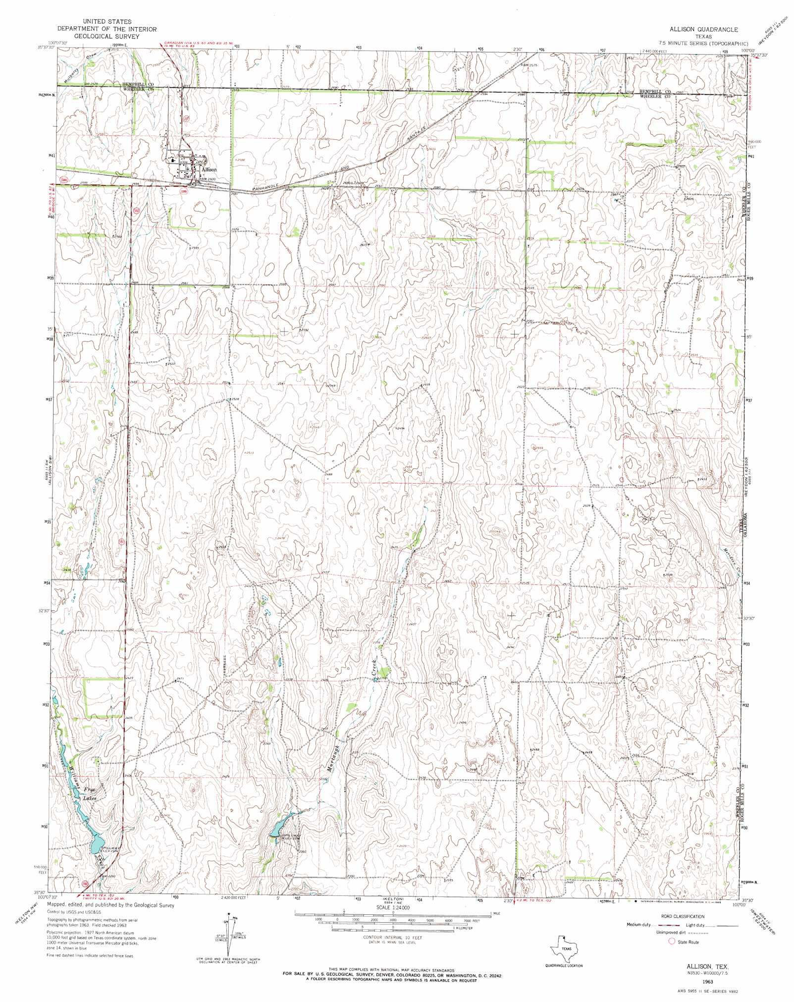
USGS Topo Quad 35100e1 - 1:24,000 scale
| Topo Map Name: | Allison |
| USGS Topo Quad ID: | 35100e1 |
| Print Size: | ca. 21 1/4" wide x 27" high |
| Southeast Coordinates: | 35.5° N latitude / 100° W longitude |
| Map Center Coordinates: | 35.5625° N latitude / 100.0625° W longitude |
| U.S. State: | TX |
| Filename: | o35100e1.jpg |
| Download Map JPG Image: | Allison topo map 1:24,000 scale |
| Map Type: | Topographic |
| Topo Series: | 7.5´ |
| Map Scale: | 1:24,000 |
| Source of Map Images: | United States Geological Survey (USGS) |
| Alternate Map Versions: |
Allison TX 1963, updated 1965 Download PDF Buy paper map Allison TX 2010 Download PDF Buy paper map Allison TX 2012 Download PDF Buy paper map Allison TX 2016 Download PDF Buy paper map |
1:24,000 Topo Quads surrounding Allison
Canadian Se |
Blue Ridge School |
Gem |
Durham |
Crawford |
Dads Creek |
Lake June |
Hackberry Creek |
Reydon |
Mackie |
Briscoe |
Allison Sw |
Allison |
Reydon Sw |
Dempsey |
Wheeler |
Kelton Nw |
Kelton |
Sweetwater |
Grimes |
Wheeler Se |
Twitty |
Kelton Se |
Mayfield |
Prentiss |
> Back to 35100e1 at 1:100,000 scale
> Back to 35100a1 at 1:250,000 scale
> Back to U.S. Topo Maps home
Allison topo map: Gazetteer
Allison: Populated Places
Allison elevation 794m 2604′Allison: Reservoirs
Frye Lakes elevation 703m 2306′Allison digital topo map on disk
Buy this Allison topo map showing relief, roads, GPS coordinates and other geographical features, as a high-resolution digital map file on DVD: