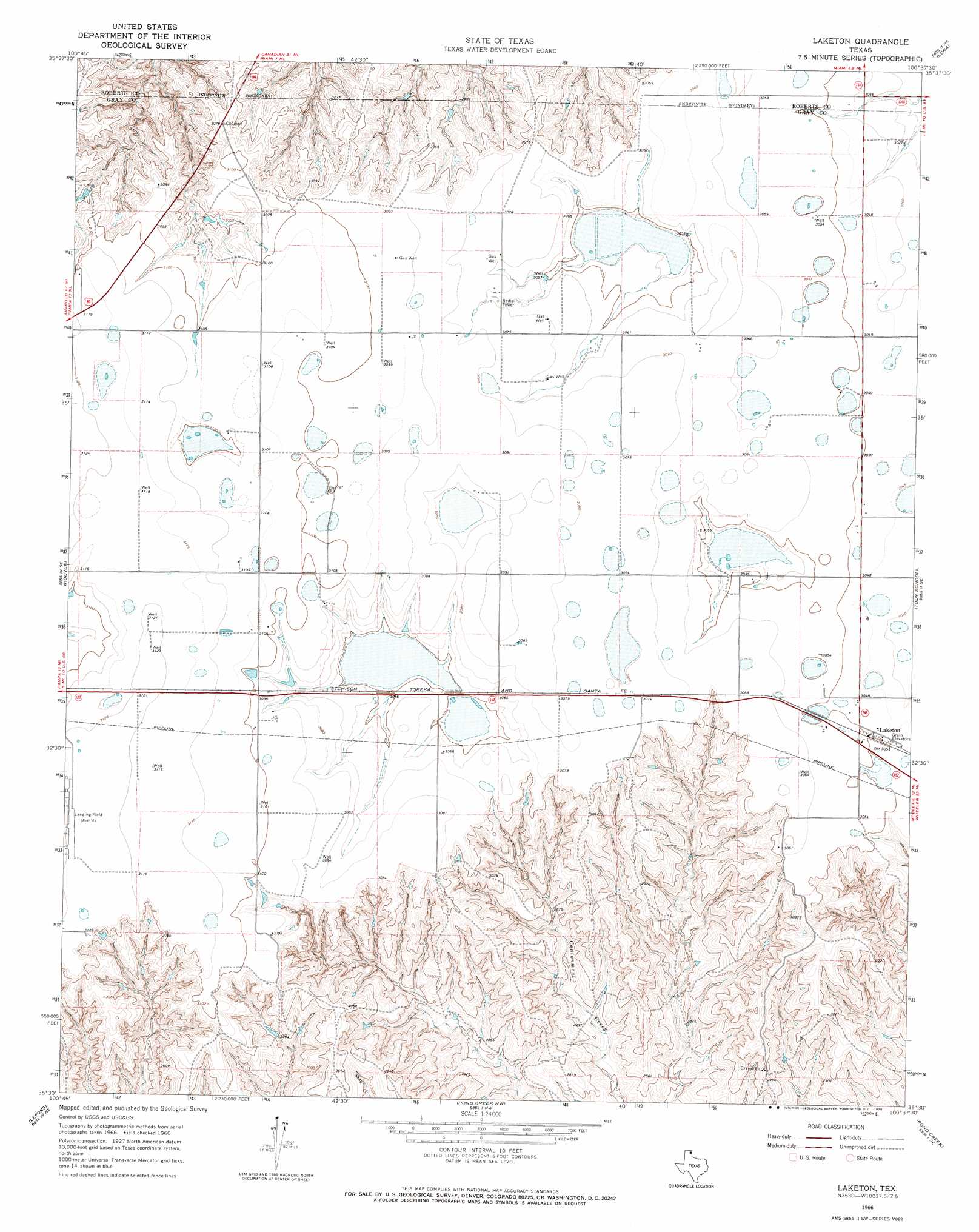
Laketon Topo Map Texas
To zoom in, hover over the map of Laketon
USGS Topo Quad 35100e6 - 1:24,000 scale
| Topo Map Name: | Laketon |
| USGS Topo Quad ID: | 35100e6 |
| Print Size: | ca. 21 1/4" wide x 27" high |
| Southeast Coordinates: | 35.5° N latitude / 100.625° W longitude |
| Map Center Coordinates: | 35.5625° N latitude / 100.6875° W longitude |
| U.S. State: | TX |
| Filename: | o35100e6.jpg |
| Download Map JPG Image: | Laketon topo map 1:24,000 scale |
| Map Type: | Topographic |
| Topo Series: | 7.5´ |
| Map Scale: | 1:24,000 |
| Source of Map Images: | United States Geological Survey (USGS) |
| Alternate Map Versions: |
Laketon TX 1966, updated 1970 Download PDF Buy paper map Laketon TX 2010 Download PDF Buy paper map Laketon TX 2012 Download PDF Buy paper map Laketon TX 2016 Download PDF Buy paper map |
1:24,000 Topo Quads surrounding Laketon
Dry Creek South |
Dry Creek Se |
Horse Creek South |
Washburn Arroyo |
Mendota |
Pampa Nw |
Pampa Ne |
Miami |
Lora |
Young Ranch |
Pampa |
Hoover |
Laketon |
Tody School |
Mobeetie |
Bowers City |
Lefors |
Pond Creek Nw |
Pond Creek |
Spring Creek |
Deep Lake |
Taylor Ranch |
Hudgens Ranch |
Back |
Pakan |
> Back to 35100e1 at 1:100,000 scale
> Back to 35100a1 at 1:250,000 scale
> Back to U.S. Topo Maps home
Laketon topo map: Gazetteer
Laketon: Dams
Locke Brothers Ranch Lake Dam elevation 894m 2933′Laketon: Populated Places
Laketon elevation 930m 3051′Laketon: Reservoirs
Locke Brothers Ranch Lake elevation 894m 2933′Laketon digital topo map on disk
Buy this Laketon topo map showing relief, roads, GPS coordinates and other geographical features, as a high-resolution digital map file on DVD: