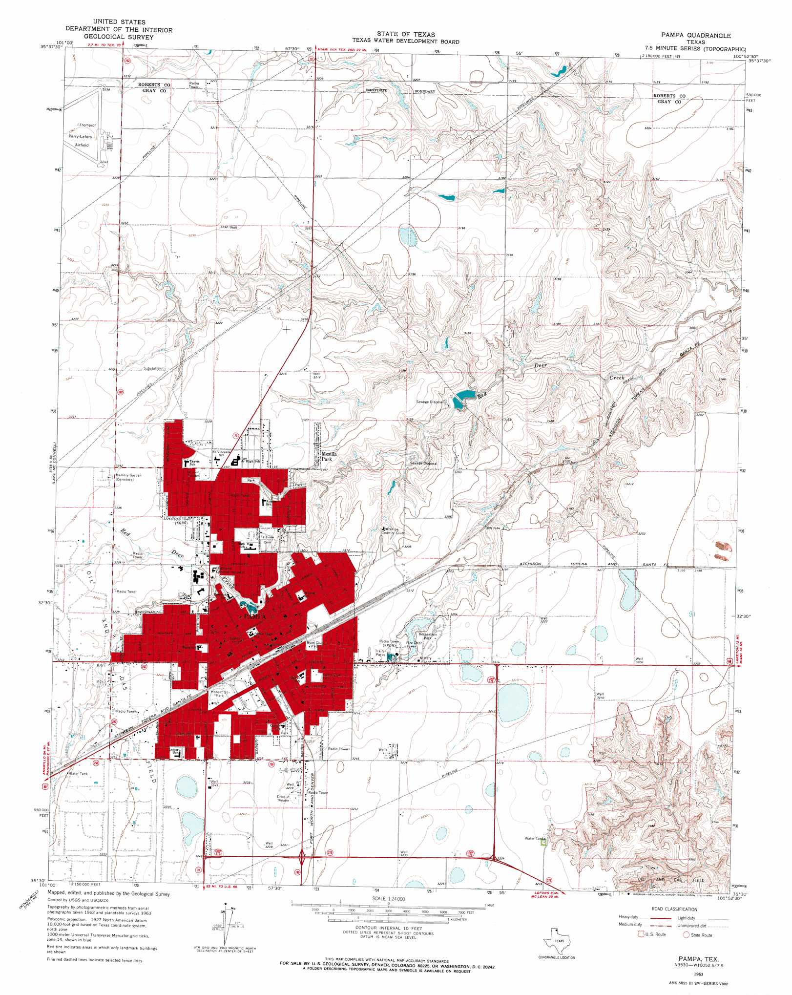
Pampa Topo Map Texas
To zoom in, hover over the map of Pampa
USGS Topo Quad 35100e8 - 1:24,000 scale
| Topo Map Name: | Pampa |
| USGS Topo Quad ID: | 35100e8 |
| Print Size: | ca. 21 1/4" wide x 27" high |
| Southeast Coordinates: | 35.5° N latitude / 100.875° W longitude |
| Map Center Coordinates: | 35.5625° N latitude / 100.9375° W longitude |
| U.S. State: | TX |
| Filename: | o35100e8.jpg |
| Download Map JPG Image: | Pampa topo map 1:24,000 scale |
| Map Type: | Topographic |
| Topo Series: | 7.5´ |
| Map Scale: | 1:24,000 |
| Source of Map Images: | United States Geological Survey (USGS) |
| Alternate Map Versions: |
Pampa TX 1963, updated 1968 Download PDF Buy paper map Pampa TX 2010 Download PDF Buy paper map Pampa TX 2012 Download PDF Buy paper map Pampa TX 2016 Download PDF Buy paper map |
1:24,000 Topo Quads surrounding Pampa
Adobe Creek Sw |
Adobe Creek Se |
Dry Creek South |
Dry Creek Se |
Horse Creek South |
Skellytown Nw |
Skellytown Ne |
Pampa Nw |
Pampa Ne |
Miami |
Skellytown |
Lake Mcconnell |
Pampa |
Hoover |
Laketon |
White Deer |
Kingsmill |
Bowers City |
Lefors |
Pond Creek Nw |
White Deer Sw |
Grandview School |
Deep Lake |
Taylor Ranch |
Hudgens Ranch |
> Back to 35100e1 at 1:100,000 scale
> Back to 35100a1 at 1:250,000 scale
> Back to U.S. Topo Maps home
Pampa topo map: Gazetteer
Pampa: Airports
Perry Lefors Field elevation 988m 3241′Pampa: Dams
City of Pampa Lake Dam elevation 976m 3202′Pampa: Parks
Aspen Park elevation 979m 3211′Boys Club Park elevation 985m 3231′
Central Park elevation 971m 3185′
Coronado Park elevation 979m 3211′
Evergreen City Park elevation 973m 3192′
Highland Park elevation 976m 3202′
Hobart Street Park elevation 987m 3238′
Hollywood Park elevation 986m 3234′
Lions Club Park elevation 985m 3231′
Lions Park elevation 985m 3231′
Marcus Sanders Park elevation 986m 3234′
Mora Park elevation 982m 3221′
Prairie Park elevation 987m 3238′
Priest Park elevation 976m 3202′
Recreational Park elevation 976m 3202′
Pampa: Populated Places
Mesilla Park elevation 976m 3202′Pampa elevation 987m 3238′
Pampa: Reservoirs
City of Pampa Lake elevation 976m 3202′Pampa digital topo map on disk
Buy this Pampa topo map showing relief, roads, GPS coordinates and other geographical features, as a high-resolution digital map file on DVD: