Lake Marvin Topo Map Texas
To zoom in, hover over the map of Lake Marvin
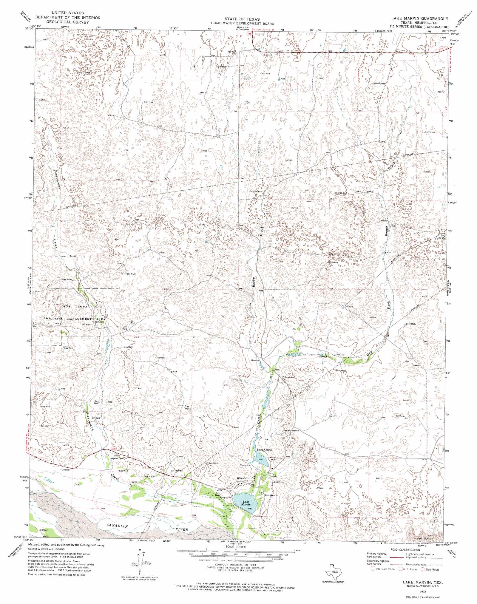
USGS Topo Quad 35100h2 - 1:24,000 scale
| Topo Map Name: | Lake Marvin |
| USGS Topo Quad ID: | 35100h2 |
| Print Size: | ca. 21 1/4" wide x 27" high |
| Southeast Coordinates: | 35.875° N latitude / 100.125° W longitude |
| Map Center Coordinates: | 35.9375° N latitude / 100.1875° W longitude |
| U.S. State: | TX |
| Filename: | o35100h2.jpg |
| Download Map JPG Image: | Lake Marvin topo map 1:24,000 scale |
| Map Type: | Topographic |
| Topo Series: | 7.5´ |
| Map Scale: | 1:24,000 |
| Source of Map Images: | United States Geological Survey (USGS) |
| Alternate Map Versions: |
Lake Marvin TX 1972, updated 1974 Download PDF Buy paper map Lake Marvin TX 1998, updated 2001 Download PDF Buy paper map Lake Marvin TX 2010 Download PDF Buy paper map Lake Marvin TX 2012 Download PDF Buy paper map Lake Marvin TX 2016 Download PDF Buy paper map |
| FStopo: | US Forest Service topo Lake Marvin is available: Download FStopo PDF Download FStopo TIF |
1:24,000 Topo Quads surrounding Lake Marvin
Barton Corners |
Lipscomb |
Willow Creek |
Higgins North |
Goodwin |
Lipscomb Sw |
Glazier |
Coburn |
Higgins South |
Arnett Sw |
Canadian West |
Canadian East |
Lake Marvin |
Dreyfoos |
Antelope Hills |
Mendota |
Canadian Se |
Blue Ridge School |
Gem |
Durham |
Young Ranch |
Dads Creek |
Lake June |
Hackberry Creek |
Reydon |
> Back to 35100e1 at 1:100,000 scale
> Back to 35100a1 at 1:250,000 scale
> Back to U.S. Topo Maps home
Lake Marvin topo map: Gazetteer
Lake Marvin: Dams
Lake Marvin Dam elevation 690m 2263′M K Brown Reservoir Dam elevation 698m 2290′
Lake Marvin: Populated Places
Springers Ranch (historical) elevation 681m 2234′Lake Marvin: Reservoirs
Lake Kiowa elevation 699m 2293′Lake Marvin elevation 690m 2263′
M K Brown Reservoir elevation 698m 2290′
Lake Marvin: Streams
Boggy Creek elevation 680m 2230′Dry Fork Boggy Creek elevation 707m 2319′
Persimmon Creek elevation 685m 2247′
Lake Marvin digital topo map on disk
Buy this Lake Marvin topo map showing relief, roads, GPS coordinates and other geographical features, as a high-resolution digital map file on DVD: