East Dry Creek Topo Map Texas
To zoom in, hover over the map of East Dry Creek
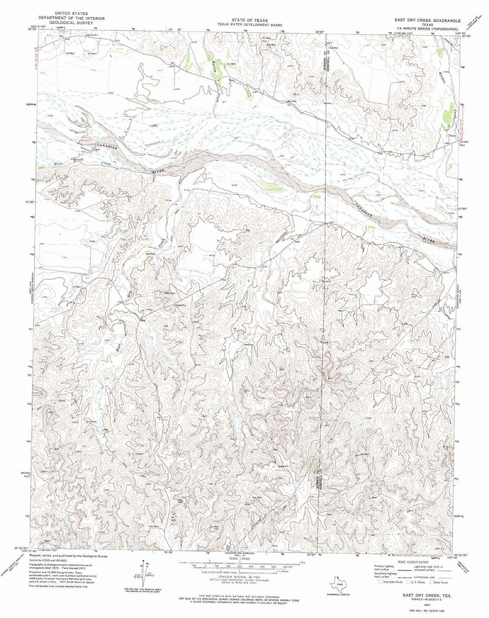
USGS Topo Quad 35100h5 - 1:24,000 scale
| Topo Map Name: | East Dry Creek |
| USGS Topo Quad ID: | 35100h5 |
| Print Size: | ca. 21 1/4" wide x 27" high |
| Southeast Coordinates: | 35.875° N latitude / 100.5° W longitude |
| Map Center Coordinates: | 35.9375° N latitude / 100.5625° W longitude |
| U.S. State: | TX |
| Filename: | o35100h5.jpg |
| Download Map JPG Image: | East Dry Creek topo map 1:24,000 scale |
| Map Type: | Topographic |
| Topo Series: | 7.5´ |
| Map Scale: | 1:24,000 |
| Source of Map Images: | United States Geological Survey (USGS) |
| Alternate Map Versions: |
East Dry Creek TX 1972, updated 1974 Download PDF Buy paper map East Dry Creek TX 2010 Download PDF Buy paper map East Dry Creek TX 2012 Download PDF Buy paper map East Dry Creek TX 2016 Download PDF Buy paper map |
1:24,000 Topo Quads surrounding East Dry Creek
Sourdough Creek Ne |
Lake Fryer |
Lake Fryer Ne |
Barton Corners |
Lipscomb |
Sourdough Creek |
Pickett Ranch Creek |
Barton Creek |
Lipscomb Sw |
Glazier |
Dry Creek Ne |
Horse Creek North |
East Dry Creek |
Canadian West |
Canadian East |
Dry Creek Se |
Horse Creek South |
Washburn Arroyo |
Mendota |
Canadian Se |
Pampa Ne |
Miami |
Lora |
Young Ranch |
Dads Creek |
> Back to 35100e1 at 1:100,000 scale
> Back to 35100a1 at 1:250,000 scale
> Back to U.S. Topo Maps home
East Dry Creek topo map: Gazetteer
East Dry Creek: Dams
Jim Waterfield Lake Dam elevation 774m 2539′East Dry Creek: Reservoirs
Jim Waterfield Lake elevation 774m 2539′East Dry Creek: Springs
Waterfield Springs elevation 793m 2601′East Dry Creek: Streams
Barton Creek elevation 728m 2388′East Dry Creek elevation 728m 2388′
Hackberry Creek elevation 730m 2395′
Home Ranch Creek elevation 729m 2391′
Morgan Creek elevation 730m 2395′
East Dry Creek digital topo map on disk
Buy this East Dry Creek topo map showing relief, roads, GPS coordinates and other geographical features, as a high-resolution digital map file on DVD: