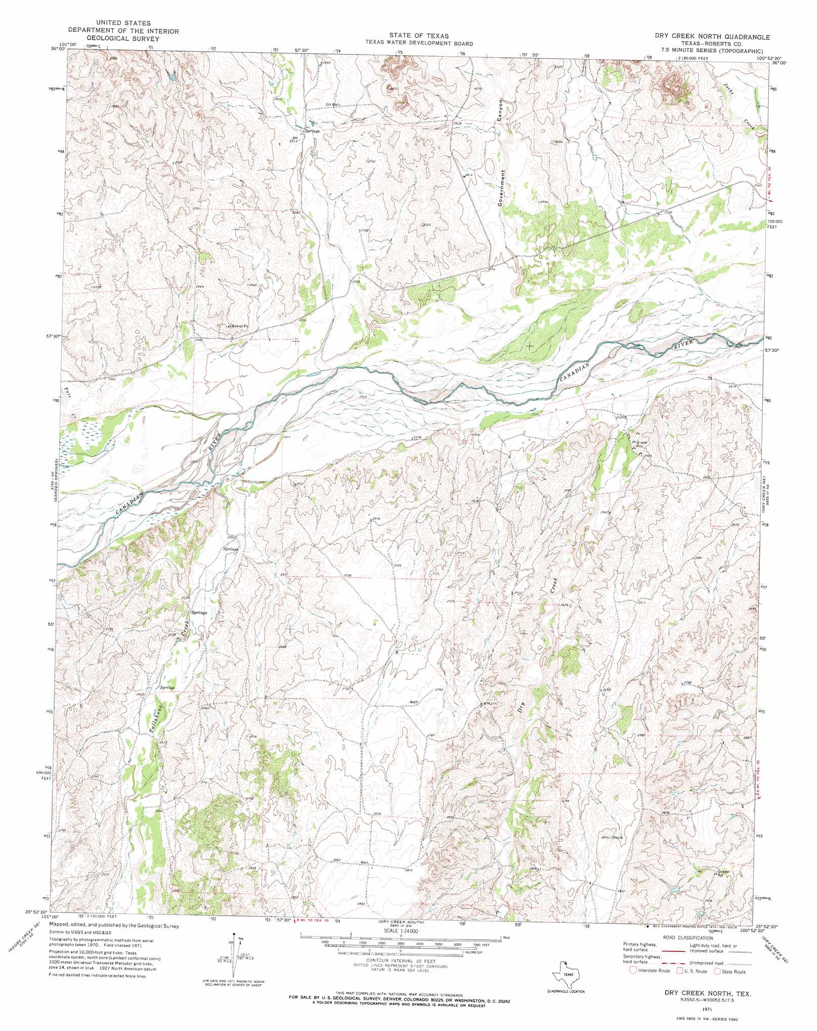
Dry Creek North Topo Map Texas
To zoom in, hover over the map of Dry Creek North
USGS Topo Quad 35100h8 - 1:24,000 scale
| Topo Map Name: | Dry Creek North |
| USGS Topo Quad ID: | 35100h8 |
| Print Size: | ca. 21 1/4" wide x 27" high |
| Southeast Coordinates: | 35.875° N latitude / 100.875° W longitude |
| Map Center Coordinates: | 35.9375° N latitude / 100.9375° W longitude |
| U.S. State: | TX |
| Filename: | o35100h8.jpg |
| Download Map JPG Image: | Dry Creek North topo map 1:24,000 scale |
| Map Type: | Topographic |
| Topo Series: | 7.5´ |
| Map Scale: | 1:24,000 |
| Source of Map Images: | United States Geological Survey (USGS) |
| Alternate Map Versions: |
Dry Creek North TX 1971, updated 1974 Download PDF Buy paper map Dry Creek North TX 2010 Download PDF Buy paper map Dry Creek North TX 2012 Download PDF Buy paper map Dry Creek North TX 2016 Download PDF Buy paper map |
1:24,000 Topo Quads surrounding Dry Creek North
Spearman |
Spearman Ne |
Sourdough Creek Nw |
Sourdough Creek Ne |
Lake Fryer |
Holt |
Spearman Se |
Sourdough Creek Sw |
Sourdough Creek |
Pickett Ranch Creek |
Adobe Creek |
Garden Springs |
Dry Creek North |
Dry Creek Ne |
Horse Creek North |
Adobe Creek Sw |
Adobe Creek Se |
Dry Creek South |
Dry Creek Se |
Horse Creek South |
Skellytown Nw |
Skellytown Ne |
Pampa Nw |
Pampa Ne |
Miami |
> Back to 35100e1 at 1:100,000 scale
> Back to 35100a1 at 1:250,000 scale
> Back to U.S. Topo Maps home
Dry Creek North topo map: Gazetteer
Dry Creek North: Springs
Whitsell Springs elevation 793m 2601′Dry Creek North: Streams
Dry Creek elevation 765m 2509′Pats Creek elevation 775m 2542′
Tallahone Creek elevation 774m 2539′
Dry Creek North: Valleys
Government Canyon elevation 773m 2536′Dry Creek North digital topo map on disk
Buy this Dry Creek North topo map showing relief, roads, GPS coordinates and other geographical features, as a high-resolution digital map file on DVD: