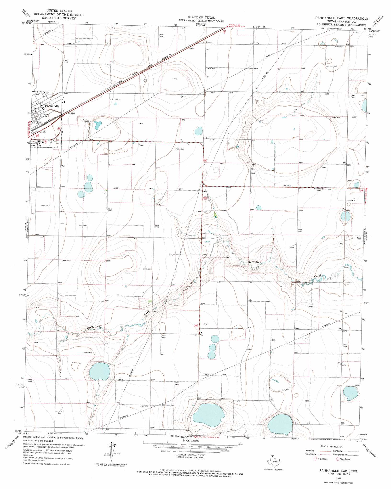
Panhandle East Topo Map Texas
To zoom in, hover over the map of Panhandle East
USGS Topo Quad 35101c3 - 1:24,000 scale
| Topo Map Name: | Panhandle East |
| USGS Topo Quad ID: | 35101c3 |
| Print Size: | ca. 21 1/4" wide x 27" high |
| Southeast Coordinates: | 35.25° N latitude / 101.25° W longitude |
| Map Center Coordinates: | 35.3125° N latitude / 101.3125° W longitude |
| U.S. State: | TX |
| Filename: | o35101c3.jpg |
| Download Map JPG Image: | Panhandle East topo map 1:24,000 scale |
| Map Type: | Topographic |
| Topo Series: | 7.5´ |
| Map Scale: | 1:24,000 |
| Source of Map Images: | United States Geological Survey (USGS) |
| Alternate Map Versions: |
Panhandle East TX 1966, updated 1967 Download PDF Buy paper map Panhandle East TX 2010 Download PDF Buy paper map Panhandle East TX 2012 Download PDF Buy paper map Panhandle East TX 2016 Download PDF Buy paper map |
1:24,000 Topo Quads surrounding Panhandle East
Deal |
Mcbride |
Borger Se |
Skellytown |
Lake Mcconnell |
Pomeroy |
Abell |
Cuyler |
White Deer |
Kingsmill |
Sevenmile Basin |
Panhandle West |
Panhandle East |
White Deer Sw |
Grandview School |
Washburn |
Conway |
Claude Ne |
Lark |
Groom |
Fairview |
Claude Sw |
Claude |
Goodnight |
Ashtola |
> Back to 35101a1 at 1:100,000 scale
> Back to 35100a1 at 1:250,000 scale
> Back to U.S. Topo Maps home
Panhandle East topo map: Gazetteer
Panhandle East: Airports
Panhandle-Carson County Airport elevation 1052m 3451′Panhandle East: Dams
Soil Conservation Service Site 1 Dam elevation 1023m 3356′Panhandle East: Parks
Rotary Park elevation 1053m 3454′Panhandle East: Reservoirs
Soil Conservation Service Site 1 Reservoir elevation 1023m 3356′Panhandle East digital topo map on disk
Buy this Panhandle East topo map showing relief, roads, GPS coordinates and other geographical features, as a high-resolution digital map file on DVD: