Kingsmill Topo Map Texas
To zoom in, hover over the map of Kingsmill
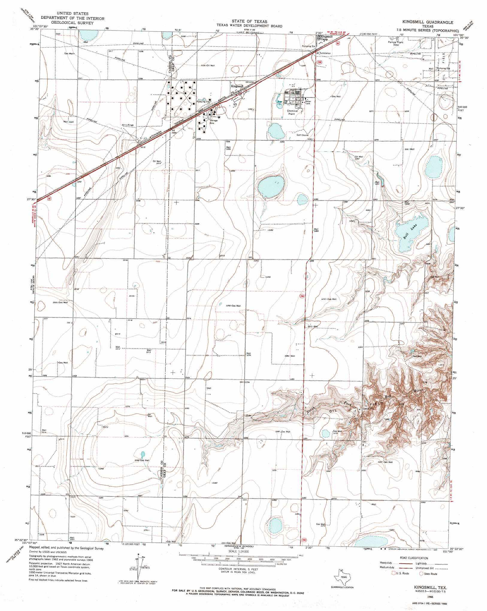
USGS Topo Quad 35101d1 - 1:24,000 scale
| Topo Map Name: | Kingsmill |
| USGS Topo Quad ID: | 35101d1 |
| Print Size: | ca. 21 1/4" wide x 27" high |
| Southeast Coordinates: | 35.375° N latitude / 101° W longitude |
| Map Center Coordinates: | 35.4375° N latitude / 101.0625° W longitude |
| U.S. State: | TX |
| Filename: | o35101d1.jpg |
| Download Map JPG Image: | Kingsmill topo map 1:24,000 scale |
| Map Type: | Topographic |
| Topo Series: | 7.5´ |
| Map Scale: | 1:24,000 |
| Source of Map Images: | United States Geological Survey (USGS) |
| Alternate Map Versions: |
Kingsmill TX 1966, updated 1967 Download PDF Buy paper map Kingsmill TX 2010 Download PDF Buy paper map Kingsmill TX 2012 Download PDF Buy paper map Kingsmill TX 2016 Download PDF Buy paper map |
1:24,000 Topo Quads surrounding Kingsmill
Phillips |
Skellytown Nw |
Skellytown Ne |
Pampa Nw |
Pampa Ne |
Borger Se |
Skellytown |
Lake Mcconnell |
Pampa |
Hoover |
Cuyler |
White Deer |
Kingsmill |
Bowers City |
Lefors |
Panhandle East |
White Deer Sw |
Grandview School |
Deep Lake |
Taylor Ranch |
Claude Ne |
Lark |
Groom |
Jericho |
Rockledge |
> Back to 35101a1 at 1:100,000 scale
> Back to 35100a1 at 1:250,000 scale
> Back to U.S. Topo Maps home
Kingsmill topo map: Gazetteer
Kingsmill: Lakes
Bell Lake elevation 978m 3208′Kingsmill: Populated Places
Kingsmill elevation 1006m 3300′Kingsmill Camp elevation 1001m 3284′
Kingsmill digital topo map on disk
Buy this Kingsmill topo map showing relief, roads, GPS coordinates and other geographical features, as a high-resolution digital map file on DVD: