Chunky Topo Map Texas
To zoom in, hover over the map of Chunky
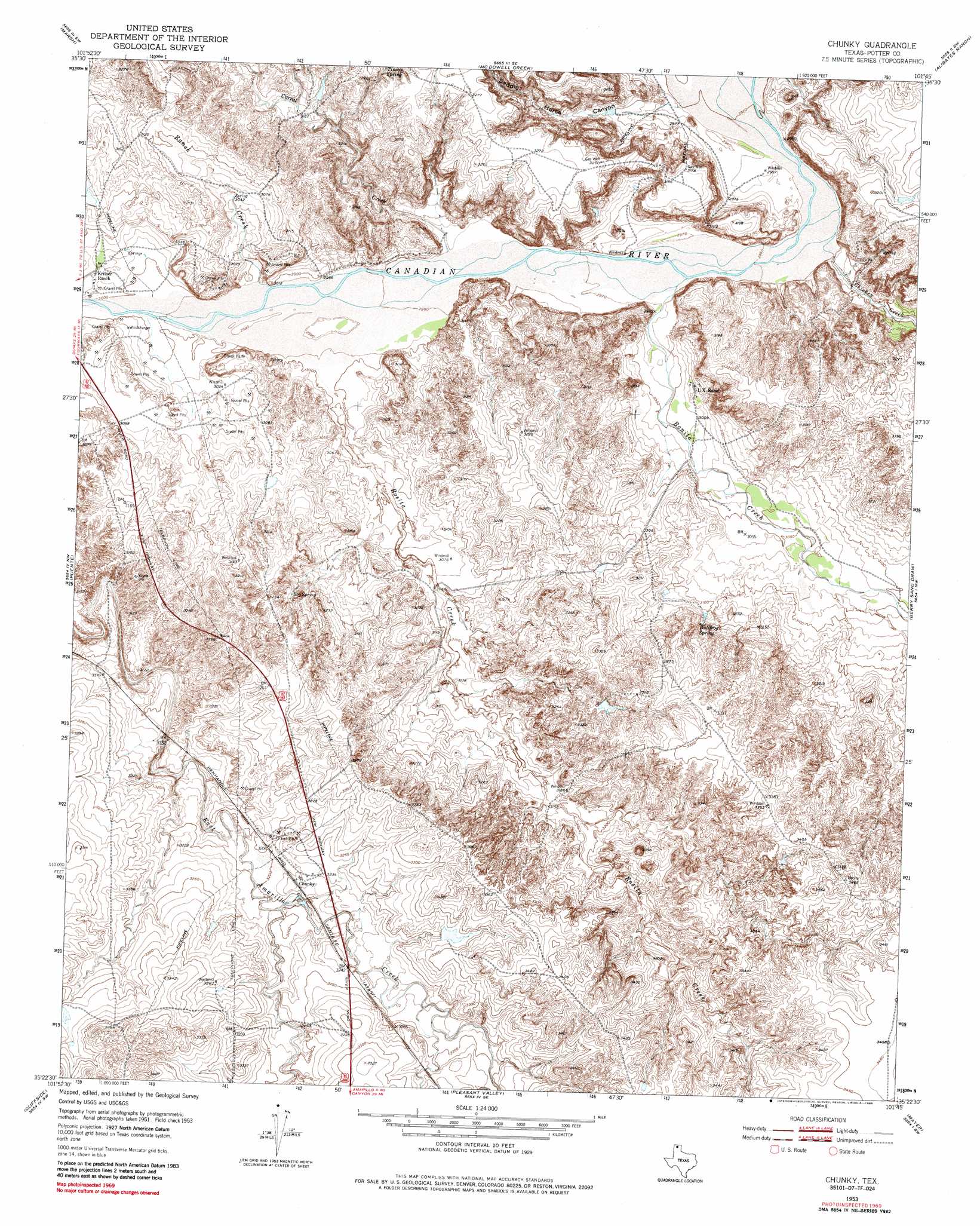
USGS Topo Quad 35101d7 - 1:24,000 scale
| Topo Map Name: | Chunky |
| USGS Topo Quad ID: | 35101d7 |
| Print Size: | ca. 21 1/4" wide x 27" high |
| Southeast Coordinates: | 35.375° N latitude / 101.75° W longitude |
| Map Center Coordinates: | 35.4375° N latitude / 101.8125° W longitude |
| U.S. State: | TX |
| Filename: | o35101d7.jpg |
| Download Map JPG Image: | Chunky topo map 1:24,000 scale |
| Map Type: | Topographic |
| Topo Series: | 7.5´ |
| Map Scale: | 1:24,000 |
| Source of Map Images: | United States Geological Survey (USGS) |
| Alternate Map Versions: |
Chunky TX 1953, updated 1954 Download PDF Buy paper map Chunky TX 1953, updated 1977 Download PDF Buy paper map Chunky TX 1953, updated 1985 Download PDF Buy paper map Chunky TX 2010 Download PDF Buy paper map Chunky TX 2012 Download PDF Buy paper map Chunky TX 2016 Download PDF Buy paper map |
1:24,000 Topo Quads surrounding Chunky
Bautista |
Masterson |
Spencer Draw |
Evans Canyon |
Sanford |
Little Indian Creek |
Marsh |
Mcdowell Creek |
Alibates Ranch |
Deal |
Boden |
Puente |
Chunky |
Berry Sand Draw |
Pomeroy |
Wolf Mountain |
Cliffside |
Pleasant Valley |
Mayer |
Sevenmile Basin |
Bushland |
Amarillo West |
Amarillo East |
Pullman |
Washburn |
> Back to 35101a1 at 1:100,000 scale
> Back to 35100a1 at 1:250,000 scale
> Back to U.S. Topo Maps home
Chunky topo map: Gazetteer
Chunky: Populated Places
Chunky elevation 982m 3221′Chunky: Springs
Bog Spring elevation 966m 3169′Bullfrog Spring elevation 951m 3120′
Tincup Spring elevation 987m 3238′
Chunky: Streams
Bonita Creek elevation 905m 2969′Chicken Creek elevation 901m 2956′
Corral Creek elevation 908m 2979′
Ranch Creek elevation 912m 2992′
Rosita Creek elevation 912m 2992′
Chunky: Valleys
Frio Draw elevation 965m 3166′Saddle Horse Canyon elevation 904m 2965′
Tincup Draw elevation 954m 3129′
Chunky digital topo map on disk
Buy this Chunky topo map showing relief, roads, GPS coordinates and other geographical features, as a high-resolution digital map file on DVD: