Puente Topo Map Texas
To zoom in, hover over the map of Puente
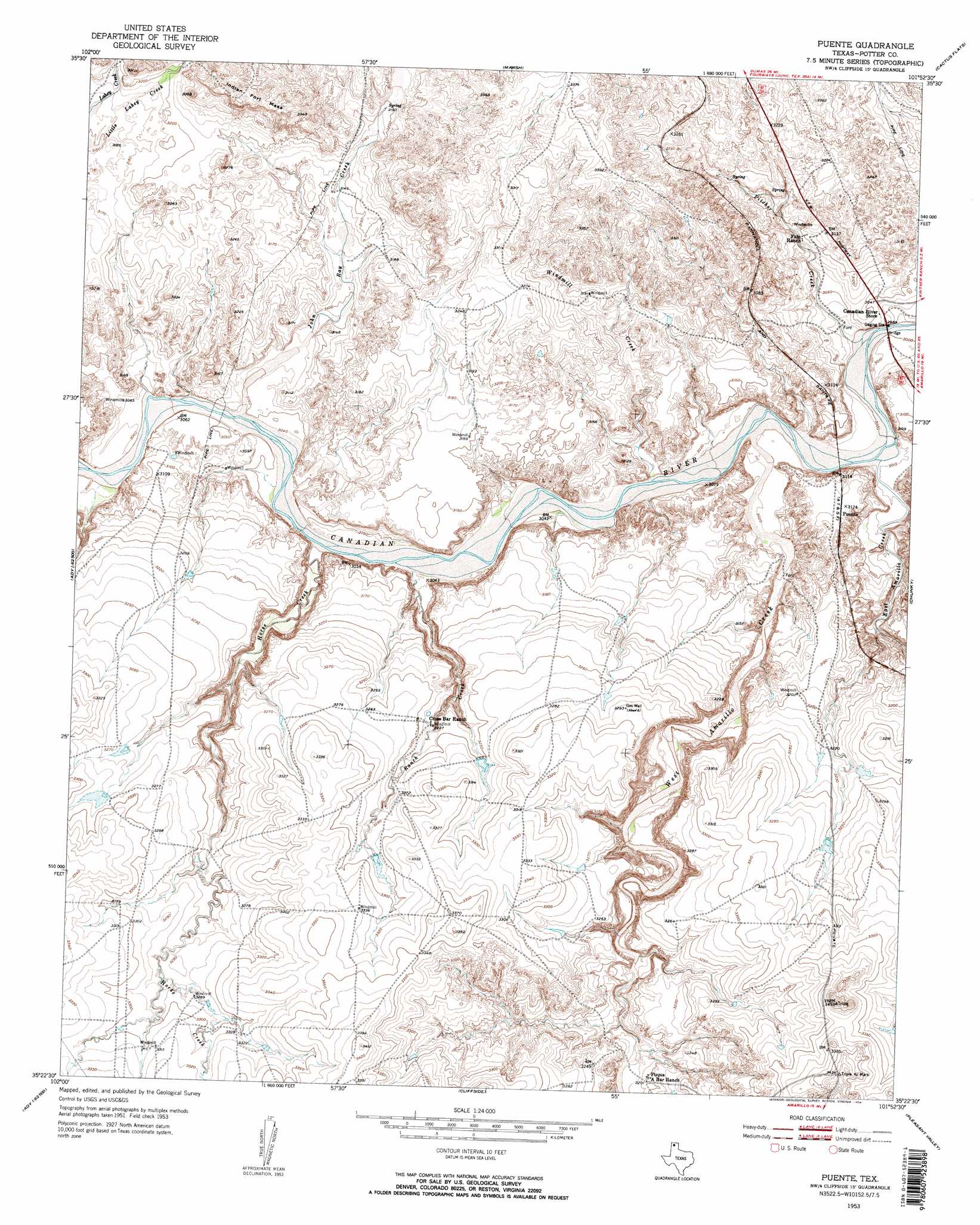
USGS Topo Quad 35101d8 - 1:24,000 scale
| Topo Map Name: | Puente |
| USGS Topo Quad ID: | 35101d8 |
| Print Size: | ca. 21 1/4" wide x 27" high |
| Southeast Coordinates: | 35.375° N latitude / 101.875° W longitude |
| Map Center Coordinates: | 35.4375° N latitude / 101.9375° W longitude |
| U.S. State: | TX |
| Filename: | o35101d8.jpg |
| Download Map JPG Image: | Puente topo map 1:24,000 scale |
| Map Type: | Topographic |
| Topo Series: | 7.5´ |
| Map Scale: | 1:24,000 |
| Source of Map Images: | United States Geological Survey (USGS) |
| Alternate Map Versions: |
Puente TX 1953, updated 1954 Download PDF Buy paper map Puente TX 1953, updated 1954 Download PDF Buy paper map Puente TX 2010 Download PDF Buy paper map Puente TX 2012 Download PDF Buy paper map Puente TX 2016 Download PDF Buy paper map |
1:24,000 Topo Quads surrounding Puente
Bivins Channing Ranch |
Bautista |
Masterson |
Spencer Draw |
Evans Canyon |
Boys Ranch East |
Little Indian Creek |
Marsh |
Mcdowell Creek |
Alibates Ranch |
Ady |
Boden |
Puente |
Chunky |
Berry Sand Draw |
Rotten Hill |
Wolf Mountain |
Cliffside |
Pleasant Valley |
Mayer |
Wildorado |
Bushland |
Amarillo West |
Amarillo East |
Pullman |
> Back to 35101a1 at 1:100,000 scale
> Back to 35100a1 at 1:250,000 scale
> Back to U.S. Topo Maps home
Puente topo map: Gazetteer
Puente: Populated Places
Puente elevation 955m 3133′Puente: Streams
East Amarillo Creek elevation 917m 3008′Horse Creek elevation 921m 3021′
John Ray Creek elevation 925m 3034′
Pitcher Creek elevation 912m 2992′
Ranch Creek elevation 924m 3031′
West Amarillo Creek elevation 917m 3008′
Windmill Creek elevation 919m 3015′
Puente: Summits
Indian Fort Mesa elevation 1006m 3300′Puente digital topo map on disk
Buy this Puente topo map showing relief, roads, GPS coordinates and other geographical features, as a high-resolution digital map file on DVD: