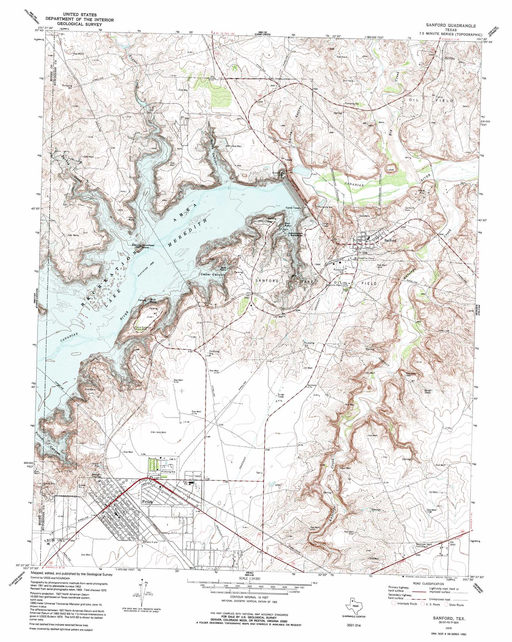
Sanford Topo Map Texas
To zoom in, hover over the map of Sanford
USGS Topo Quad 35101f5 - 1:24,000 scale
| Topo Map Name: | Sanford |
| USGS Topo Quad ID: | 35101f5 |
| Print Size: | ca. 21 1/4" wide x 27" high |
| Southeast Coordinates: | 35.625° N latitude / 101.5° W longitude |
| Map Center Coordinates: | 35.6875° N latitude / 101.5625° W longitude |
| U.S. State: | TX |
| Filename: | o35101f5.jpg |
| Download Map JPG Image: | Sanford topo map 1:24,000 scale |
| Map Type: | Topographic |
| Topo Series: | 7.5´ |
| Map Scale: | 1:24,000 |
| Source of Map Images: | United States Geological Survey (USGS) |
| Alternate Map Versions: |
Sanford TX 1953 Download PDF Buy paper map Sanford TX 1970, updated 1973 Download PDF Buy paper map Sanford TX 2010 Download PDF Buy paper map Sanford TX 2012 Download PDF Buy paper map Sanford TX 2016 Download PDF Buy paper map |
1:24,000 Topo Quads surrounding Sanford
Dumas Ne |
Pollard Creek Nw |
Pollard Creek Ne |
Pringle |
Stinnett Station |
Little Blue Creek |
Pollard Creek |
Camp Creek |
Stinnett |
Plemons |
Spencer Draw |
Evans Canyon |
Sanford |
Borger |
Phillips |
Mcdowell Creek |
Alibates Ranch |
Deal |
Mcbride |
Borger Se |
Chunky |
Berry Sand Draw |
Pomeroy |
Abell |
Cuyler |
> Back to 35101e1 at 1:100,000 scale
> Back to 35100a1 at 1:250,000 scale
> Back to U.S. Topo Maps home
Sanford topo map: Gazetteer
Sanford: Dams
Sanford Dam elevation 896m 2939′Sanford: Islands
Arrowhead Island elevation 897m 2942′Sanford: Oilfields
Sanford Yake Oil Field elevation 922m 3024′Sanford: Parks
Sanford Recreational Area elevation 922m 3024′Sanford: Populated Places
Fritch elevation 974m 3195′Oil City elevation 902m 2959′
Sanford elevation 925m 3034′
Sanford: Reservoirs
Lake Meredith elevation 896m 2939′Sanford: Streams
Big Creek elevation 854m 2801′Bugbee Creek elevation 895m 2936′
Camp Creek elevation 862m 2828′
Turkey Creek elevation 895m 2936′
Sanford: Valleys
Bugbee Canyon elevation 895m 2936′Cedar Canyon elevation 895m 2936′
North Canyon elevation 895m 2936′
Spring Canyon elevation 861m 2824′
Sanford digital topo map on disk
Buy this Sanford topo map showing relief, roads, GPS coordinates and other geographical features, as a high-resolution digital map file on DVD: