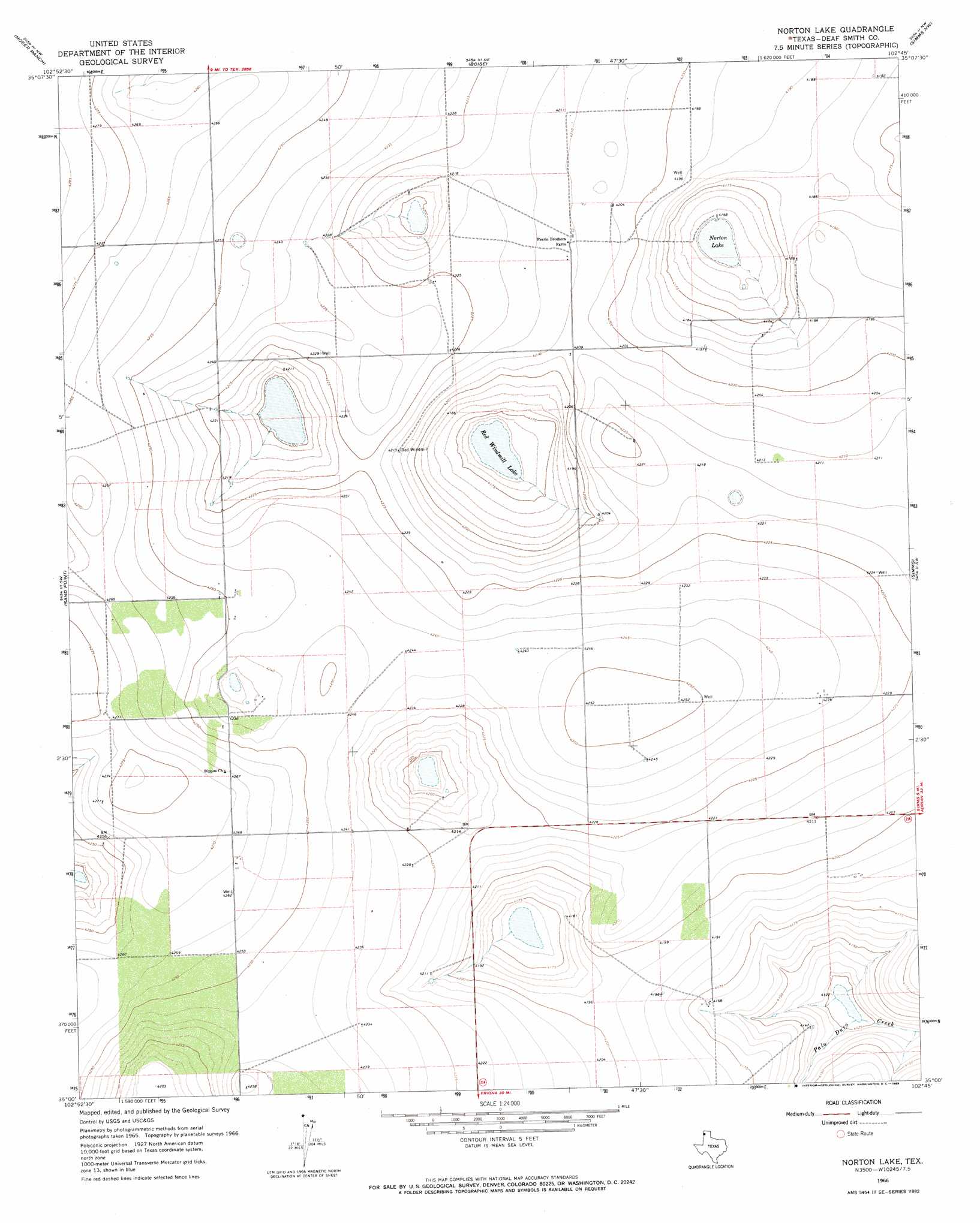
Norton Lake Topo Map Texas
To zoom in, hover over the map of Norton Lake
USGS Topo Quad 35102a7 - 1:24,000 scale
| Topo Map Name: | Norton Lake |
| USGS Topo Quad ID: | 35102a7 |
| Print Size: | ca. 21 1/4" wide x 27" high |
| Southeast Coordinates: | 35° N latitude / 102.75° W longitude |
| Map Center Coordinates: | 35.0625° N latitude / 102.8125° W longitude |
| U.S. State: | TX |
| Filename: | o35102a7.jpg |
| Download Map JPG Image: | Norton Lake topo map 1:24,000 scale |
| Map Type: | Topographic |
| Topo Series: | 7.5´ |
| Map Scale: | 1:24,000 |
| Source of Map Images: | United States Geological Survey (USGS) |
| Alternate Map Versions: |
Norton Lake TX 1966, updated 1969 Download PDF Buy paper map Norton Lake TX 2010 Download PDF Buy paper map Norton Lake TX 2012 Download PDF Buy paper map Norton Lake TX 2016 Download PDF Buy paper map |
1:24,000 Topo Quads surrounding Norton Lake
Martin Draw |
Signal Spring |
Signal Spring Se |
Adrian |
Landergin |
Glenrio |
Moser Ranch |
Boise |
Simms Nw |
Simms Ne |
Rock Camp |
Sand Point |
Norton Lake |
Simms |
Overstreet Lake |
Endee Hill |
Mustang Lake |
Walcott |
Westway Nw |
Westway Ne |
Bellview |
Garcia Lake |
Bootleg |
Chalk Hill |
Westway |
> Back to 35102a1 at 1:100,000 scale
> Back to 35102a1 at 1:250,000 scale
> Back to U.S. Topo Maps home
Norton Lake topo map: Gazetteer
Norton Lake: Lakes
Norton Lake elevation 1266m 4153′Red Windmill Lake elevation 1269m 4163′
Norton Lake digital topo map on disk
Buy this Norton Lake topo map showing relief, roads, GPS coordinates and other geographical features, as a high-resolution digital map file on DVD: