Vega South Topo Map Texas
To zoom in, hover over the map of Vega South
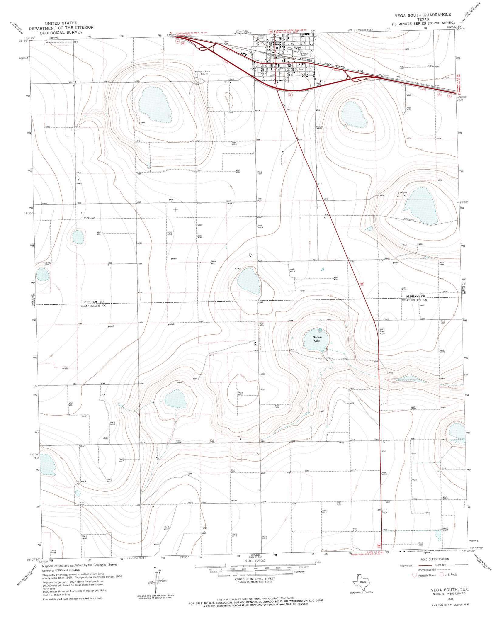
USGS Topo Quad 35102b4 - 1:24,000 scale
| Topo Map Name: | Vega South |
| USGS Topo Quad ID: | 35102b4 |
| Print Size: | ca. 21 1/4" wide x 27" high |
| Southeast Coordinates: | 35.125° N latitude / 102.375° W longitude |
| Map Center Coordinates: | 35.1875° N latitude / 102.4375° W longitude |
| U.S. State: | TX |
| Filename: | o35102b4.jpg |
| Download Map JPG Image: | Vega South topo map 1:24,000 scale |
| Map Type: | Topographic |
| Topo Series: | 7.5´ |
| Map Scale: | 1:24,000 |
| Source of Map Images: | United States Geological Survey (USGS) |
| Alternate Map Versions: |
Vega South TX 1966, updated 1969 Download PDF Buy paper map Vega South TX 2010 Download PDF Buy paper map Vega South TX 2012 Download PDF Buy paper map Vega South TX 2016 Download PDF Buy paper map |
1:24,000 Topo Quads surrounding Vega South
Big George Tank |
Alamocitos Camp |
Torrea Peak |
Halfway Creek |
Ady |
Adrian |
Landergin |
Vega North |
Jay Taylor Ranch |
Rotten Hill |
Simms Nw |
Simms Ne |
Vega South |
Everett |
Wildorado |
Simms |
Overstreet Lake |
Ford |
Allison Ranch |
Wildorado Sw |
Westway Nw |
Westway Ne |
Milo Center |
Hereford Ne |
Dawn |
> Back to 35102a1 at 1:100,000 scale
> Back to 35102a1 at 1:250,000 scale
> Back to U.S. Topo Maps home
Vega South topo map: Gazetteer
Vega South: Airports
Oldham County Airport elevation 1214m 3982′Vega South: Lakes
Dodson Lake elevation 1203m 3946′Vega South: Populated Places
Vega elevation 1228m 4028′Vega South digital topo map on disk
Buy this Vega South topo map showing relief, roads, GPS coordinates and other geographical features, as a high-resolution digital map file on DVD: