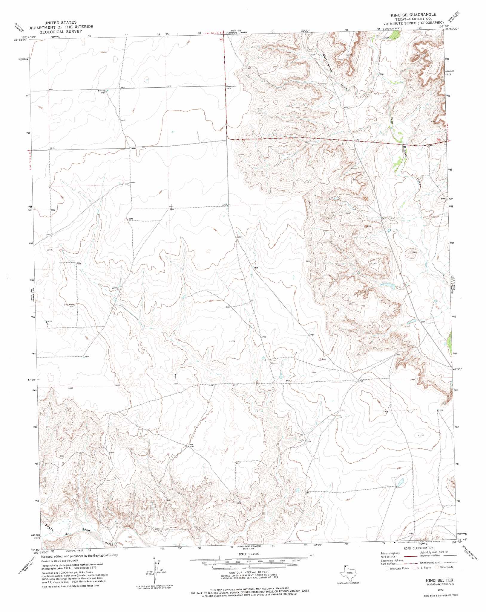
King Se Topo Map Texas
To zoom in, hover over the map of King Se
USGS Topo Quad 35102g5 - 1:24,000 scale
| Topo Map Name: | King Se |
| USGS Topo Quad ID: | 35102g5 |
| Print Size: | ca. 21 1/4" wide x 27" high |
| Southeast Coordinates: | 35.75° N latitude / 102.5° W longitude |
| Map Center Coordinates: | 35.8125° N latitude / 102.5625° W longitude |
| U.S. State: | TX |
| Filename: | o35102g5.jpg |
| Download Map JPG Image: | King Se topo map 1:24,000 scale |
| Map Type: | Topographic |
| Topo Series: | 7.5´ |
| Map Scale: | 1:24,000 |
| Source of Map Images: | United States Geological Survey (USGS) |
| Alternate Map Versions: |
King SE TX 1973, updated 1976 Download PDF Buy paper map King SE TX 2010 Download PDF Buy paper map King SE TX 2012 Download PDF Buy paper map King SE TX 2016 Download PDF Buy paper map |
1:24,000 Topo Quads surrounding King Se
Wells Ranch |
Canyon School |
Dalhart West |
Dalhart East |
Wilco |
Syndicate Hills |
King |
Pardue Camp |
Hartley |
Hartley Ne |
Middle Water |
King Sw |
King Se |
Hartley Sw |
Hartley Se |
Spring Creek Ranch |
Pedarosa Camp |
Proctor Ranch |
Channing Nw |
Channing |
Romero Se |
Humdinger Spring |
Many Post Camp |
Torrey House |
Boys Ranch West |
> Back to 35102e1 at 1:100,000 scale
> Back to 35102a1 at 1:250,000 scale
> Back to U.S. Topo Maps home
King Se topo map: Gazetteer
King Se: Springs
XIT Springs (historical) elevation 1108m 3635′King Se: Valleys
Cottonwood Draw elevation 1108m 3635′King Se: Wells
Bishop Well elevation 1196m 3923′King Se digital topo map on disk
Buy this King Se topo map showing relief, roads, GPS coordinates and other geographical features, as a high-resolution digital map file on DVD: