King Topo Map Texas
To zoom in, hover over the map of King
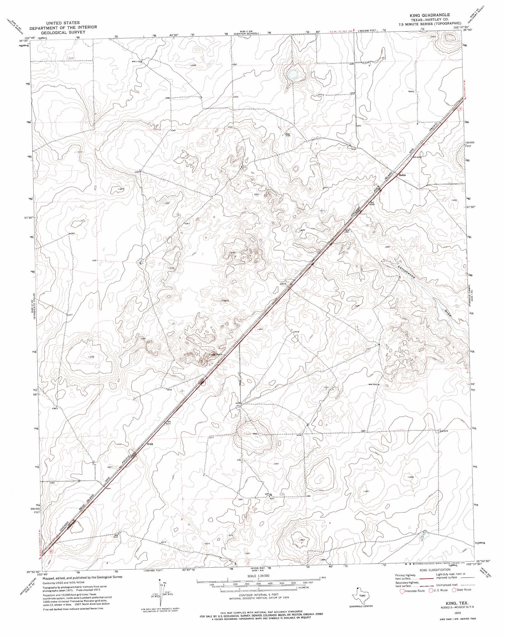
USGS Topo Quad 35102h6 - 1:24,000 scale
| Topo Map Name: | King |
| USGS Topo Quad ID: | 35102h6 |
| Print Size: | ca. 21 1/4" wide x 27" high |
| Southeast Coordinates: | 35.875° N latitude / 102.625° W longitude |
| Map Center Coordinates: | 35.9375° N latitude / 102.6875° W longitude |
| U.S. State: | TX |
| Filename: | o35102h6.jpg |
| Download Map JPG Image: | King topo map 1:24,000 scale |
| Map Type: | Topographic |
| Topo Series: | 7.5´ |
| Map Scale: | 1:24,000 |
| Source of Map Images: | United States Geological Survey (USGS) |
| Alternate Map Versions: |
King TX 1973, updated 1975 Download PDF Buy paper map King TX 2010 Download PDF Buy paper map King TX 2012 Download PDF Buy paper map King TX 2016 Download PDF Buy paper map |
1:24,000 Topo Quads surrounding King
Windy Hill Nw |
Wharton Ranch |
Bolin |
Bolin Ne |
Chamberlin |
Windy Hill |
Wells Ranch |
Canyon School |
Dalhart West |
Dalhart East |
Beck Ranch |
Syndicate Hills |
King |
Pardue Camp |
Hartley |
Whiteaker Ranch |
Middle Water |
King Sw |
King Se |
Hartley Sw |
Romero |
Spring Creek Ranch |
Pedarosa Camp |
Proctor Ranch |
Channing Nw |
> Back to 35102e1 at 1:100,000 scale
> Back to 35102a1 at 1:250,000 scale
> Back to U.S. Topo Maps home
King digital topo map on disk
Buy this King topo map showing relief, roads, GPS coordinates and other geographical features, as a high-resolution digital map file on DVD: