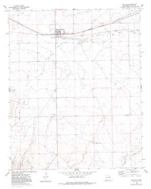
San Jon Topo Map New Mexico
To zoom in, hover over the map of San Jon
USGS Topo Quad 35103a3 - 1:24,000 scale
| Topo Map Name: | San Jon |
| USGS Topo Quad ID: | 35103a3 |
| Print Size: | ca. 21 1/4" wide x 27" high |
| Southeast Coordinates: | 35° N latitude / 103.25° W longitude |
| Map Center Coordinates: | 35.0625° N latitude / 103.3125° W longitude |
| U.S. State: | NM |
| Filename: | o35103a3.jpg |
| Download Map JPG Image: | San Jon topo map 1:24,000 scale |
| Map Type: | Topographic |
| Topo Series: | 7.5´ |
| Map Scale: | 1:24,000 |
| Source of Map Images: | United States Geological Survey (USGS) |
| Alternate Map Versions: |
San Jon NM 1968, updated 1971 Download PDF Buy paper map San Jon NM 1968, updated 1982 Download PDF Buy paper map San Jon NM 1968, updated 1982 Download PDF Buy paper map San Jon NM 2010 Download PDF Buy paper map San Jon NM 2013 Download PDF Buy paper map San Jon NM 2017 Download PDF Buy paper map |
1:24,000 Topo Quads surrounding San Jon
> Back to 35103a1 at 1:100,000 scale
> Back to 35102a1 at 1:250,000 scale
> Back to U.S. Topo Maps home
San Jon topo map: Gazetteer
San Jon: Parks
Llano Estacado Historical Marker elevation 1231m 4038′San Jon: Populated Places
Pleasant Valley (historical) elevation 1263m 4143′San Jon elevation 1229m 4032′
San Jon: Post Offices
San Jon Post Office elevation 1229m 4032′San Jon: Wells
05183 Water Well elevation 1224m 4015′05187 Water Well elevation 1240m 4068′
05189 Water Well elevation 1244m 4081′
05192 Water Well elevation 1247m 4091′
05195 Water Well elevation 1270m 4166′
05196 Water Well elevation 1244m 4081′
05198 Water Well elevation 1249m 4097′
05199 Water Well elevation 1249m 4097′
West Well elevation 1239m 4064′
San Jon digital topo map on disk
Buy this San Jon topo map showing relief, roads, GPS coordinates and other geographical features, as a high-resolution digital map file on DVD:


