Tucumcari Topo Map New Mexico
To zoom in, hover over the map of Tucumcari
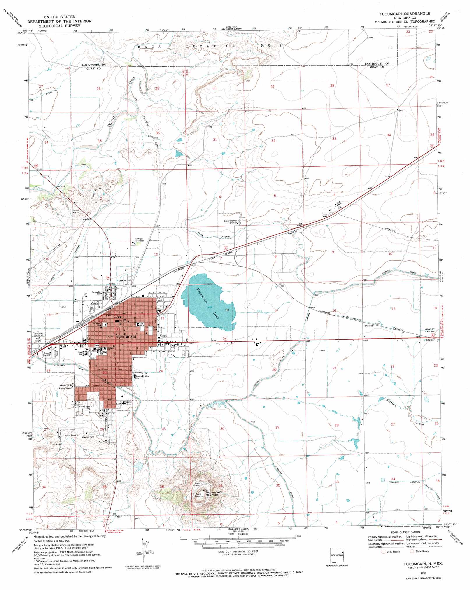
USGS Topo Quad 35103b6 - 1:24,000 scale
| Topo Map Name: | Tucumcari |
| USGS Topo Quad ID: | 35103b6 |
| Print Size: | ca. 21 1/4" wide x 27" high |
| Southeast Coordinates: | 35.125° N latitude / 103.625° W longitude |
| Map Center Coordinates: | 35.1875° N latitude / 103.6875° W longitude |
| U.S. State: | NM |
| Filename: | o35103b6.jpg |
| Download Map JPG Image: | Tucumcari topo map 1:24,000 scale |
| Map Type: | Topographic |
| Topo Series: | 7.5´ |
| Map Scale: | 1:24,000 |
| Source of Map Images: | United States Geological Survey (USGS) |
| Alternate Map Versions: |
Tucumcari NM 1967, updated 1971 Download PDF Buy paper map Tucumcari NM 2010 Download PDF Buy paper map Tucumcari NM 2013 Download PDF Buy paper map Tucumcari NM 2017 Download PDF Buy paper map |
1:24,000 Topo Quads surrounding Tucumcari
Carpenter Mesa Nw |
Medina Mesa |
Hampton Ranch |
Montesito Creek |
Logan North |
Carpenter Mesa Sw |
Trinchera Creek |
Bascom Camp |
Hudson |
Logan South |
Cow Canyon |
Liberty Mesa |
Tucumcari |
Lesbia |
San Jon Nw |
Quemado Hills |
Briscoe Ranch |
Bulldog Mesa |
Tucumcari Se |
Bedford Hill |
Circle S Mesa |
Quay |
Mesa Redonda |
Norton |
Apache Canyon |
> Back to 35103a1 at 1:100,000 scale
> Back to 35102a1 at 1:250,000 scale
> Back to U.S. Topo Maps home
Tucumcari topo map: Gazetteer
Tucumcari: Canals
Bell Lateral elevation 1222m 4009′Farm Lateral elevation 1242m 4074′
Savage Lateral elevation 1235m 4051′
Tucumcari Lateral elevation 1246m 4087′
Tucumcari: Lakes
Tucumcari Lake elevation 1222m 4009′Tucumcari: Parks
Comanche Country Historical Marker elevation 1509m 4950′East Side Park elevation 1240m 4068′
Tucumcari Historical Marker elevation 1247m 4091′
Tucumcari Mountain Historical Marker elevation 1509m 4950′
Tucumcari: Populated Places
Tucumcari elevation 1247m 4091′Tucumcari: Post Offices
Douglas Post Office (historical) elevation 1247m 4091′Tucumcari Post Office elevation 1247m 4091′
Tucumcari: Summits
Tucumcari Mountain elevation 1509m 4950′Tucumcari digital topo map on disk
Buy this Tucumcari topo map showing relief, roads, GPS coordinates and other geographical features, as a high-resolution digital map file on DVD: