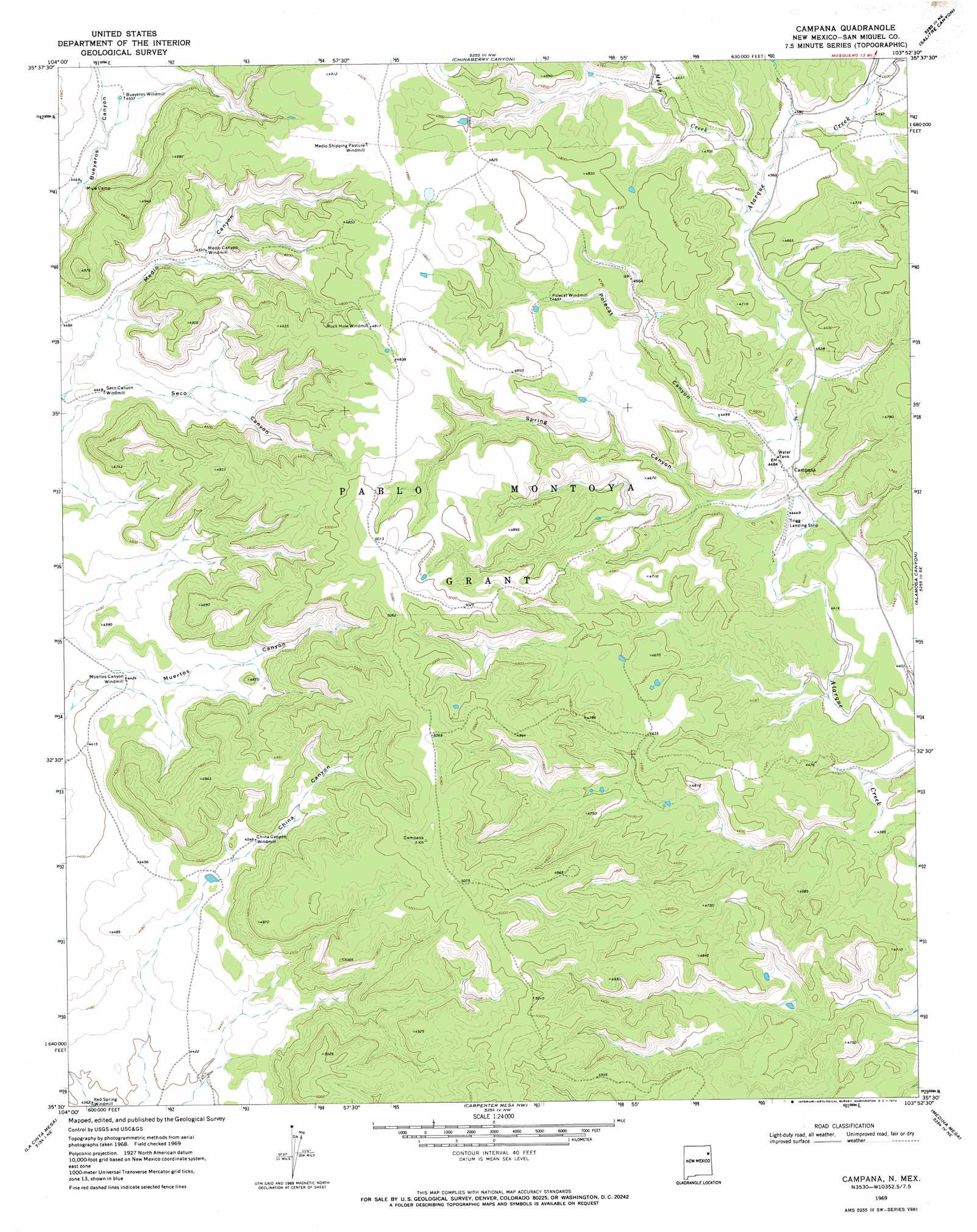
Campana Topo Map New Mexico
To zoom in, hover over the map of Campana
USGS Topo Quad 35103e8 - 1:24,000 scale
| Topo Map Name: | Campana |
| USGS Topo Quad ID: | 35103e8 |
| Print Size: | ca. 21 1/4" wide x 27" high |
| Southeast Coordinates: | 35.5° N latitude / 103.875° W longitude |
| Map Center Coordinates: | 35.5625° N latitude / 103.9375° W longitude |
| U.S. State: | NM |
| Filename: | o35103e8.jpg |
| Download Map JPG Image: | Campana topo map 1:24,000 scale |
| Map Type: | Topographic |
| Topo Series: | 7.5´ |
| Map Scale: | 1:24,000 |
| Source of Map Images: | United States Geological Survey (USGS) |
| Alternate Map Versions: |
Campana NM 1969, updated 1972 Download PDF Buy paper map Campana NM 2010 Download PDF Buy paper map Campana NM 2013 Download PDF Buy paper map Campana NM 2017 Download PDF Buy paper map |
1:24,000 Topo Quads surrounding Campana
La Cinta Canyon |
Solano |
Mosquero |
Arroyo Del Alamo |
Circle Bar Ranch |
Montoya Point |
Waggoner Ranch |
Chinaberry Canyon |
Salitre Canyon |
Buffalo Springs |
Minese Mesa |
Bell Ranch |
Campana |
Alamosa Canyon |
Gallegos |
Conchas Dam |
La Cinta Mesa |
Carpenter Mesa Nw |
Medina Mesa |
Hampton Ranch |
Tenaja Mesa |
Monument Point |
Carpenter Mesa Sw |
Trinchera Creek |
Bascom Camp |
> Back to 35103e1 at 1:100,000 scale
> Back to 35102a1 at 1:250,000 scale
> Back to U.S. Topo Maps home
Campana topo map: Gazetteer
Campana: Populated Places
Campana elevation 1364m 4475′Campana: Streams
Medio Creek elevation 1390m 4560′Campana: Valleys
Bueyeros Canyon elevation 1360m 4461′China Canyon elevation 1368m 4488′
Medio Canyon elevation 1353m 4438′
Muertos Canyon elevation 1339m 4393′
Polecat Canyon elevation 1363m 4471′
Seco Canyon elevation 1352m 4435′
Spring Canyon elevation 1363m 4471′
Campana digital topo map on disk
Buy this Campana topo map showing relief, roads, GPS coordinates and other geographical features, as a high-resolution digital map file on DVD: