Mesita De Guadalupe Topo Map New Mexico
To zoom in, hover over the map of Mesita De Guadalupe
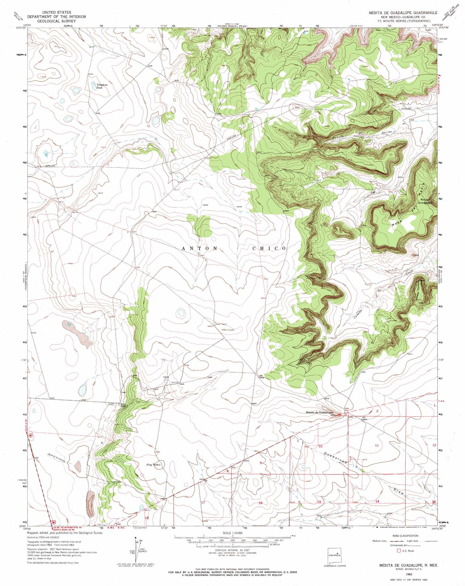
USGS Topo Quad 35104a8 - 1:24,000 scale
| Topo Map Name: | Mesita De Guadalupe |
| USGS Topo Quad ID: | 35104a8 |
| Print Size: | ca. 21 1/4" wide x 27" high |
| Southeast Coordinates: | 35° N latitude / 104.875° W longitude |
| Map Center Coordinates: | 35.0625° N latitude / 104.9375° W longitude |
| U.S. State: | NM |
| Filename: | o35104a8.jpg |
| Download Map JPG Image: | Mesita De Guadalupe topo map 1:24,000 scale |
| Map Type: | Topographic |
| Topo Series: | 7.5´ |
| Map Scale: | 1:24,000 |
| Source of Map Images: | United States Geological Survey (USGS) |
| Alternate Map Versions: |
Mesita De Guadalupe NM 1963, updated 1965 Download PDF Buy paper map Mesita De Guadalupe NM 2010 Download PDF Buy paper map Mesita De Guadalupe NM 2013 Download PDF Buy paper map Mesita De Guadalupe NM 2017 Download PDF Buy paper map |
1:24,000 Topo Quads surrounding Mesita De Guadalupe
Apache Springs |
Mesa Chupinas |
Chaperito |
Cactus Tank |
Cabra Hill |
Anton Chico |
Dilia |
Pedro Miguel Peak |
Horse Pasture Tank |
Bar Y Ranch |
Mesa Palo Amarillo |
Thompson Ranch |
Mesita De Guadalupe |
Colonias |
Catfish Falls |
Milagro |
Pintada |
San Ignacio |
Pastura Ne |
Santa Rosa |
George Ranch |
Tapia Ranch |
Pastura |
Pastura Se |
Puerto Creek |
> Back to 35104a1 at 1:100,000 scale
> Back to 35104a1 at 1:250,000 scale
> Back to U.S. Topo Maps home
Mesita De Guadalupe topo map: Gazetteer
Mesita De Guadalupe: Reservoirs
Frog Tank elevation 1677m 5501′Telephone Tank elevation 1620m 5314′
Mesita De Guadalupe: Streams
Agua de los Juanes elevation 1614m 5295′Mesita De Guadalupe: Summits
Mesa del Medio elevation 1668m 5472′Mesita Cortada elevation 1654m 5426′
Mesita de Guadalupe elevation 1712m 5616′
Mesita De Guadalupe digital topo map on disk
Buy this Mesita De Guadalupe topo map showing relief, roads, GPS coordinates and other geographical features, as a high-resolution digital map file on DVD: