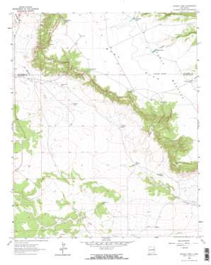
Ortega Tank Topo Map New Mexico
To zoom in, hover over the map of Ortega Tank
USGS Topo Quad 35104b2 - 1:24,000 scale
| Topo Map Name: | Ortega Tank |
| USGS Topo Quad ID: | 35104b2 |
| Print Size: | ca. 21 1/4" wide x 27" high |
| Southeast Coordinates: | 35.125° N latitude / 104.125° W longitude |
| Map Center Coordinates: | 35.1875° N latitude / 104.1875° W longitude |
| U.S. State: | NM |
| Filename: | o35104b2.jpg |
| Download Map JPG Image: | Ortega Tank topo map 1:24,000 scale |
| Map Type: | Topographic |
| Topo Series: | 7.5´ |
| Map Scale: | 1:24,000 |
| Source of Map Images: | United States Geological Survey (USGS) |
| Alternate Map Versions: |
Ortega Tank NM 1964, updated 1967 Download PDF Buy paper map Ortega Tank NM 2010 Download PDF Buy paper map Ortega Tank NM 2013 Download PDF Buy paper map Ortega Tank NM 2017 Download PDF Buy paper map |
1:24,000 Topo Quads surrounding Ortega Tank
> Back to 35104a1 at 1:100,000 scale
> Back to 35104a1 at 1:250,000 scale
> Back to U.S. Topo Maps home
Ortega Tank topo map: Gazetteer
Ortega Tank: Dams
Aragon Dam elevation 1602m 5255′Ortega Tank: Post Offices
Correo Post Office (historical) elevation 1604m 5262′Ortega Tank: Reservoirs
Aragon Tank elevation 1597m 5239′Benavidez Tank elevation 1378m 4520′
Blue Tank elevation 1581m 5187′
Corralitos Tank elevation 1604m 5262′
Kelly Tank elevation 1611m 5285′
La Munyan Tank elevation 1619m 5311′
Ortega Tank elevation 1412m 4632′
Oso Tank elevation 1586m 5203′
Padilla Tank elevation 1435m 4708′
Smith Tank elevation 1616m 5301′
Ortega Tank: Summits
Mesa Rica elevation 1648m 5406′Ortega Tank digital topo map on disk
Buy this Ortega Tank topo map showing relief, roads, GPS coordinates and other geographical features, as a high-resolution digital map file on DVD:


