Mesita Del Gato Topo Map New Mexico
To zoom in, hover over the map of Mesita Del Gato
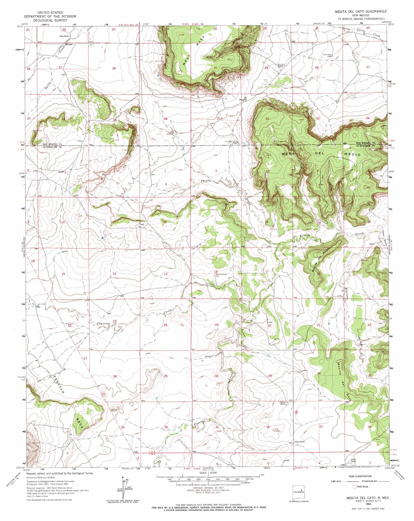
USGS Topo Quad 35104b4 - 1:24,000 scale
| Topo Map Name: | Mesita Del Gato |
| USGS Topo Quad ID: | 35104b4 |
| Print Size: | ca. 21 1/4" wide x 27" high |
| Southeast Coordinates: | 35.125° N latitude / 104.375° W longitude |
| Map Center Coordinates: | 35.1875° N latitude / 104.4375° W longitude |
| U.S. State: | NM |
| Filename: | o35104b4.jpg |
| Download Map JPG Image: | Mesita Del Gato topo map 1:24,000 scale |
| Map Type: | Topographic |
| Topo Series: | 7.5´ |
| Map Scale: | 1:24,000 |
| Source of Map Images: | United States Geological Survey (USGS) |
| Alternate Map Versions: |
Mesita Del Gato NM 1963, updated 1966 Download PDF Buy paper map Mesita Del Gato NM 2010 Download PDF Buy paper map Mesita Del Gato NM 2013 Download PDF Buy paper map Mesita Del Gato NM 2017 Download PDF Buy paper map |
1:24,000 Topo Quads surrounding Mesita Del Gato
Punta Del Chorro |
Cerro De Corazon |
Variadero |
Four V Ranch |
Conchas Dam |
Cabra Hill |
Mesa Pino |
La Silla |
Bookout Ranch |
Tenaja Mesa |
Bar Y Ranch |
Mesa Cherisco |
Mesita Del Gato |
Neafus Ranch |
Ortega Tank |
Catfish Falls |
Sacaton Draw |
Cuervo |
Newkirk |
Gate Canyon |
Santa Rosa |
Sunshine Mesa |
Harben Lake |
Salt Lake |
Ima Nw |
> Back to 35104a1 at 1:100,000 scale
> Back to 35104a1 at 1:250,000 scale
> Back to U.S. Topo Maps home
Mesita Del Gato topo map: Gazetteer
Mesita Del Gato: Gaps
El Puerto elevation 1407m 4616′Mesita Del Gato: Mines
Bookout Ranch Section 31 elevation 1403m 4603′Lookout Ranch Section Twenty Five elevation 1524m 5000′
Santa Rosa Claims elevation 1563m 5127′
Mesita Del Gato: Streams
Cherisco Creek elevation 1366m 4481′Difrises Arroyo elevation 1354m 4442′
Gonzales Creek elevation 1385m 4543′
Pino Creek elevation 1413m 4635′
Puerto Creek elevation 1360m 4461′
Mesita Del Gato: Summits
Mesa del Medio elevation 1508m 4947′Mesita del Gato elevation 1440m 4724′
Mesita del Medio elevation 1439m 4721′
West Mesa elevation 1587m 5206′
Mesita Del Gato: Valleys
Cañon Bonita elevation 1354m 4442′Mesita Del Gato: Wells
Green Well elevation 1362m 4468′New Well elevation 1394m 4573′
Mesita Del Gato digital topo map on disk
Buy this Mesita Del Gato topo map showing relief, roads, GPS coordinates and other geographical features, as a high-resolution digital map file on DVD: