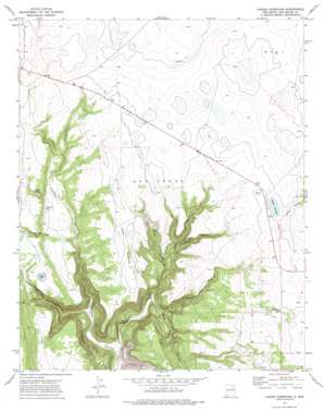
Laguna Huerfana Topo Map New Mexico
To zoom in, hover over the map of Laguna Huerfana
USGS Topo Quad 35104e7 - 1:24,000 scale
| Topo Map Name: | Laguna Huerfana |
| USGS Topo Quad ID: | 35104e7 |
| Print Size: | ca. 21 1/4" wide x 27" high |
| Southeast Coordinates: | 35.5° N latitude / 104.75° W longitude |
| Map Center Coordinates: | 35.5625° N latitude / 104.8125° W longitude |
| U.S. State: | NM |
| Filename: | o35104e7.jpg |
| Download Map JPG Image: | Laguna Huerfana topo map 1:24,000 scale |
| Map Type: | Topographic |
| Topo Series: | 7.5´ |
| Map Scale: | 1:24,000 |
| Source of Map Images: | United States Geological Survey (USGS) |
| Alternate Map Versions: |
Laguna Huerfana NM 1971, updated 1975 Download PDF Buy paper map Laguna Huerfana NM 2010 Download PDF Buy paper map Laguna Huerfana NM 2013 Download PDF Buy paper map Laguna Huerfana NM 2017 Download PDF Buy paper map |
1:24,000 Topo Quads surrounding Laguna Huerfana
> Back to 35104e1 at 1:100,000 scale
> Back to 35104a1 at 1:250,000 scale
> Back to U.S. Topo Maps home
Laguna Huerfana topo map: Gazetteer
Laguna Huerfana: Lakes
Crystal Lake elevation 1920m 6299′Laguna Huerfana elevation 1974m 6476′
Laguna Huerfana: Springs
Conchas Spring elevation 1911m 6269′Laguna Huerfana: Streams
Cañada Tuloso elevation 1749m 5738′Laguna Huerfana: Summits
Valle Redondo elevation 1953m 6407′Laguna Huerfana: Valleys
Box Canyon elevation 1799m 5902′Cañon Burro elevation 1832m 6010′
Cañon de Eugenio elevation 1761m 5777′
Cañon de las Cuevas elevation 1738m 5702′
Cañon Hondo elevation 1712m 5616′
Cañon Jaroso elevation 1832m 6010′
Cañoncito de Mogote elevation 1852m 6076′
Laguna Huerfana digital topo map on disk
Buy this Laguna Huerfana topo map showing relief, roads, GPS coordinates and other geographical features, as a high-resolution digital map file on DVD:


