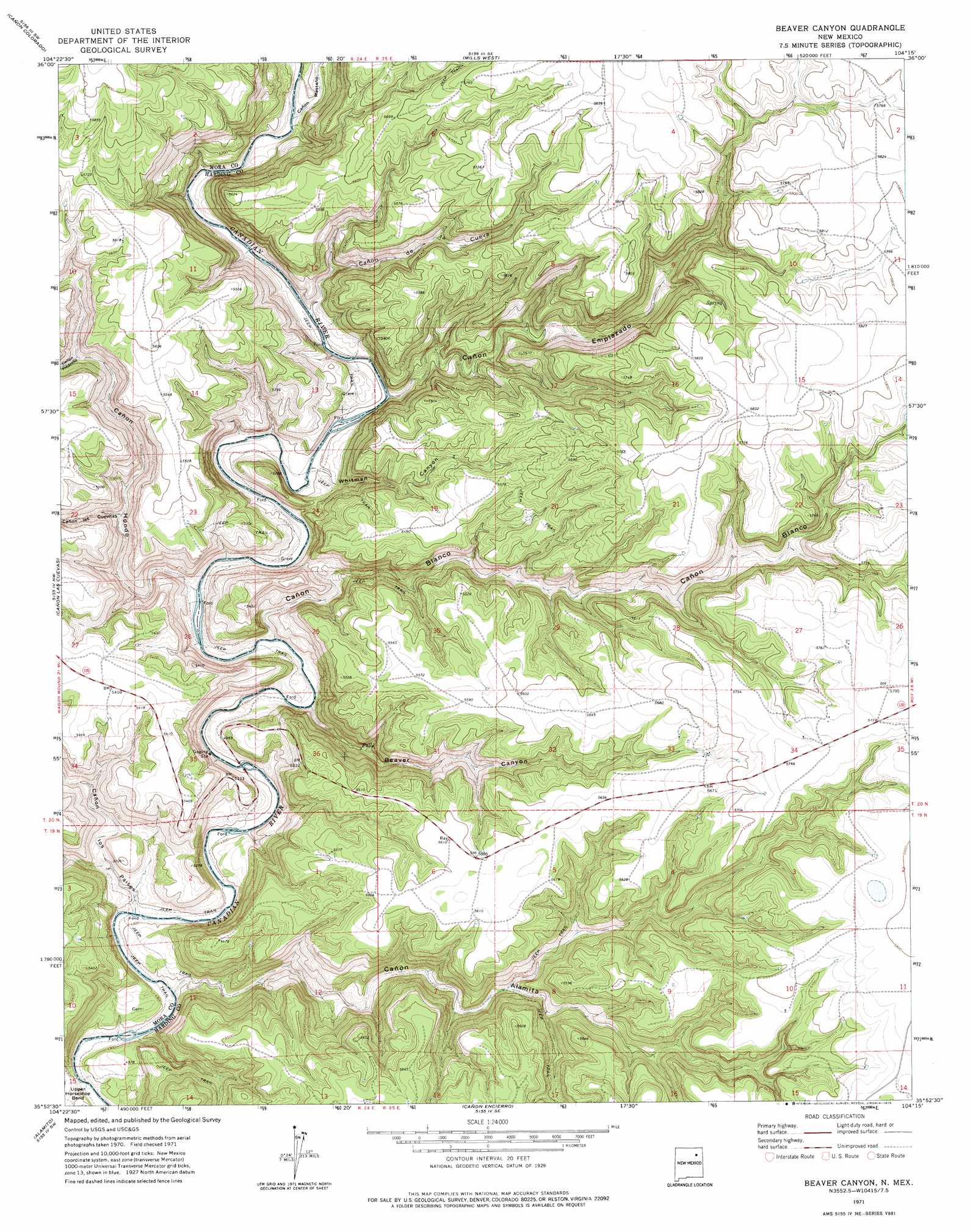
Beaver Canyon Topo Map New Mexico
To zoom in, hover over the map of Beaver Canyon
USGS Topo Quad 35104h3 - 1:24,000 scale
| Topo Map Name: | Beaver Canyon |
| USGS Topo Quad ID: | 35104h3 |
| Print Size: | ca. 21 1/4" wide x 27" high |
| Southeast Coordinates: | 35.875° N latitude / 104.25° W longitude |
| Map Center Coordinates: | 35.9375° N latitude / 104.3125° W longitude |
| U.S. State: | NM |
| Filename: | o35104h3.jpg |
| Download Map JPG Image: | Beaver Canyon topo map 1:24,000 scale |
| Map Type: | Topographic |
| Topo Series: | 7.5´ |
| Map Scale: | 1:24,000 |
| Source of Map Images: | United States Geological Survey (USGS) |
| Alternate Map Versions: |
Beaver Canyon NM 1971, updated 1975 Download PDF Buy paper map Beaver Canyon NM 1998, updated 2001 Download PDF Buy paper map Beaver Canyon NM 2011 Download PDF Buy paper map Beaver Canyon NM 2013 Download PDF Buy paper map Beaver Canyon NM 2017 Download PDF Buy paper map |
| FStopo: | US Forest Service topo Beaver Canyon is available: Download FStopo PDF Download FStopo TIF |
1:24,000 Topo Quads surrounding Beaver Canyon
Stony Lake |
Jaritas Ranch |
Abbott Lake |
Spear Hills |
Divine Lake |
Alto De Hormiga |
Canon Colorado |
Mills West |
Mills East |
Kansas Valley |
Alamosa Creek |
Canon Las Cuevas |
Beaver Canyon |
Roy |
Kansas Valley Lake |
Canon Ancho |
Alamito |
Canon Encierro |
La Cinta Canyon |
Solano |
Maes |
Sabinoso |
Arroyo Alamocito |
Montoya Point |
Waggoner Ranch |
> Back to 35104e1 at 1:100,000 scale
> Back to 35104a1 at 1:250,000 scale
> Back to U.S. Topo Maps home
Beaver Canyon topo map: Gazetteer
Beaver Canyon: Valleys
Beaver Canyon elevation 1504m 4934′Cañon Alamita elevation 1485m 4872′
Cañon Blanco elevation 1498m 4914′
Cañon de Cueva elevation 1526m 5006′
Cañon Emplazado elevation 1524m 5000′
Cañon Hondo elevation 1505m 4937′
Cañon las Cuevitas elevation 1544m 5065′
Cañon los Paises elevation 1488m 4881′
Cañon Mesteño elevation 1536m 5039′
Cañon Piedroso elevation 1595m 5232′
Whitman Canyon elevation 1519m 4983′
Beaver Canyon digital topo map on disk
Buy this Beaver Canyon topo map showing relief, roads, GPS coordinates and other geographical features, as a high-resolution digital map file on DVD: