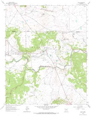
Dilia Topo Map New Mexico
To zoom in, hover over the map of Dilia
USGS Topo Quad 35105b1 - 1:24,000 scale
| Topo Map Name: | Dilia |
| USGS Topo Quad ID: | 35105b1 |
| Print Size: | ca. 21 1/4" wide x 27" high |
| Southeast Coordinates: | 35.125° N latitude / 105° W longitude |
| Map Center Coordinates: | 35.1875° N latitude / 105.0625° W longitude |
| U.S. State: | NM |
| Filename: | o35105b1.jpg |
| Download Map JPG Image: | Dilia topo map 1:24,000 scale |
| Map Type: | Topographic |
| Topo Series: | 7.5´ |
| Map Scale: | 1:24,000 |
| Source of Map Images: | United States Geological Survey (USGS) |
| Alternate Map Versions: |
Dilia NM 1963, updated 1966 Download PDF Buy paper map Dilia NM 2010 Download PDF Buy paper map Dilia NM 2013 Download PDF Buy paper map Dilia NM 2017 Download PDF Buy paper map |
1:24,000 Topo Quads surrounding Dilia
> Back to 35105a1 at 1:100,000 scale
> Back to 35104a1 at 1:250,000 scale
> Back to U.S. Topo Maps home
Dilia topo map: Gazetteer
Dilia: Canals
Acequia del Bodo Juan Paiz elevation 1587m 5206′Dilia: Populated Places
Dilia elevation 1590m 5216′Llano Del Medio elevation 1597m 5239′
Upper Dilia elevation 1593m 5226′
Dilia: Post Offices
Dilia Post Office (historical) elevation 1590m 5216′La Loma Post Office elevation 1592m 5223′
Dilia: Springs
Chupinas Spring elevation 1607m 5272′Estritos Spring elevation 1561m 5121′
Salitre Spring elevation 1563m 5127′
Dilia: Streams
Spring Creek elevation 1530m 5019′Dilia: Valleys
Cañon Blanco elevation 1558m 5111′Cañon de Rancho Alegre elevation 1588m 5209′
Dilia digital topo map on disk
Buy this Dilia topo map showing relief, roads, GPS coordinates and other geographical features, as a high-resolution digital map file on DVD:


