Laguna Ortiz Topo Map New Mexico
To zoom in, hover over the map of Laguna Ortiz
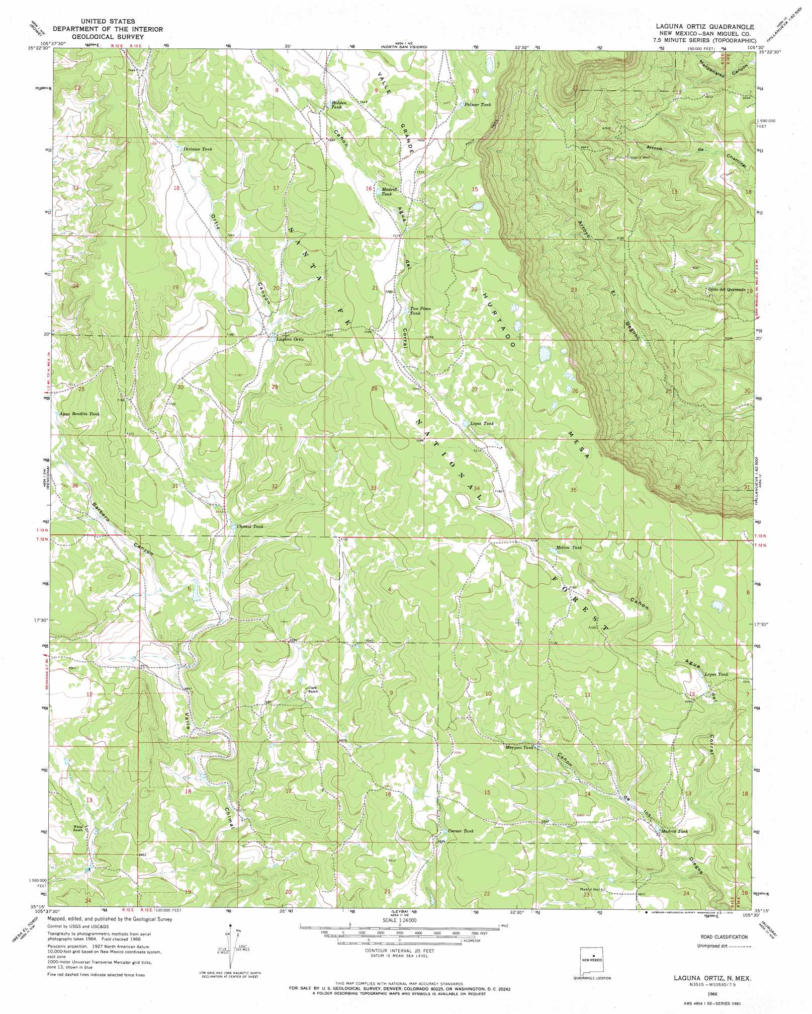
USGS Topo Quad 35105c5 - 1:24,000 scale
| Topo Map Name: | Laguna Ortiz |
| USGS Topo Quad ID: | 35105c5 |
| Print Size: | ca. 21 1/4" wide x 27" high |
| Southeast Coordinates: | 35.25° N latitude / 105.5° W longitude |
| Map Center Coordinates: | 35.3125° N latitude / 105.5625° W longitude |
| U.S. State: | NM |
| Filename: | o35105c5.jpg |
| Download Map JPG Image: | Laguna Ortiz topo map 1:24,000 scale |
| Map Type: | Topographic |
| Topo Series: | 7.5´ |
| Map Scale: | 1:24,000 |
| Source of Map Images: | United States Geological Survey (USGS) |
| Alternate Map Versions: |
Laguna Ortiz NM 1966, updated 1970 Download PDF Buy paper map Laguna Ortiz NM 2002, updated 2003 Download PDF Buy paper map Laguna Ortiz NM 2011 Download PDF Buy paper map Laguna Ortiz NM 2013 Download PDF Buy paper map Laguna Ortiz NM 2017 Download PDF Buy paper map |
| FStopo: | US Forest Service topo Laguna Ortiz is available: Download FStopo PDF Download FStopo TIF |
1:24,000 Topo Quads surrounding Laguna Ortiz
Glorieta |
Pecos |
Lower Colonias |
San Geronimo |
Ojitos Frios |
Bull Canyon |
Rowe |
North San Ysidro |
San Jose |
Tecolote |
Wildhorse Mesa |
Rencona |
Laguna Ortiz |
Sena |
Villanueva |
White |
Mesa El Toro |
Leyba |
Aurora |
San Juan |
El Cuervo Butte |
Clines Corners |
El Cabo |
Jacinto Mesa |
Potrillo Hill |
> Back to 35105a1 at 1:100,000 scale
> Back to 35104a1 at 1:250,000 scale
> Back to U.S. Topo Maps home
Laguna Ortiz topo map: Gazetteer
Laguna Ortiz: Reservoirs
Agua Bendita Tank elevation 2150m 7053′Chimal Tank elevation 2121m 6958′
Corner Tank elevation 2127m 6978′
Division Tank elevation 2228m 7309′
Hidden Tank elevation 2258m 7408′
Laguna Ortiz elevation 2182m 7158′
Lopez Tank elevation 2195m 7201′
Lopez Tank elevation 2128m 6981′
Madrid Tank elevation 2239m 7345′
Madrid Tank elevation 2071m 6794′
Marquez Tank elevation 2115m 6938′
Melton Tank elevation 2171m 7122′
Palmer Tank elevation 2263m 7424′
Two Pines Tank elevation 2219m 7280′
Wildlife Trick Tank elevation 2190m 7185′
Laguna Ortiz: Springs
Ojito del Quemado elevation 1957m 6420′Laguna Ortiz: Summits
Hurtado Mesa elevation 2270m 7447′Laguna Ortiz: Valleys
Barbero Canyon elevation 2102m 6896′Canyon del Agua del Corral elevation 2059m 6755′
Canyon del Agua del Corral elevation 2062m 6765′
Ortiz Canyon elevation 2101m 6893′
Laguna Ortiz: Wells
Cresprin Well elevation 2033m 6669′Madrid Well elevation 2093m 6866′
Laguna Ortiz digital topo map on disk
Buy this Laguna Ortiz topo map showing relief, roads, GPS coordinates and other geographical features, as a high-resolution digital map file on DVD: