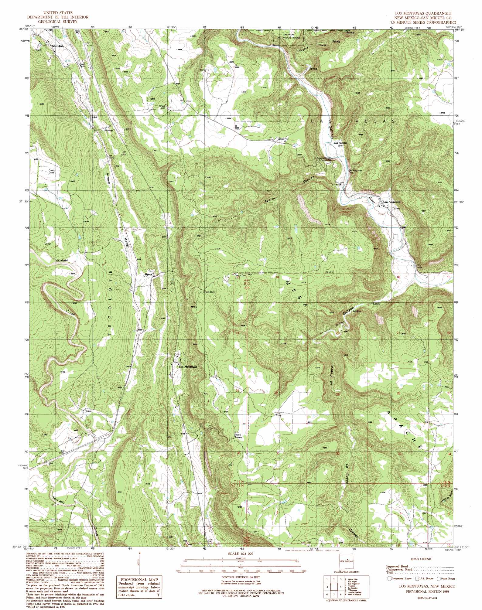
Los Montoyas Topo Map New Mexico
To zoom in, hover over the map of Los Montoyas
USGS Topo Quad 35105d2 - 1:24,000 scale
| Topo Map Name: | Los Montoyas |
| USGS Topo Quad ID: | 35105d2 |
| Print Size: | ca. 21 1/4" wide x 27" high |
| Southeast Coordinates: | 35.375° N latitude / 105.125° W longitude |
| Map Center Coordinates: | 35.4375° N latitude / 105.1875° W longitude |
| U.S. State: | NM |
| Filename: | o35105d2.jpg |
| Download Map JPG Image: | Los Montoyas topo map 1:24,000 scale |
| Map Type: | Topographic |
| Topo Series: | 7.5´ |
| Map Scale: | 1:24,000 |
| Source of Map Images: | United States Geological Survey (USGS) |
| Alternate Map Versions: |
Los Montoyas NM 1989, updated 1989 Download PDF Buy paper map Los Montoyas NM 2010 Download PDF Buy paper map Los Montoyas NM 2013 Download PDF Buy paper map Los Montoyas NM 2017 Download PDF Buy paper map |
1:24,000 Topo Quads surrounding Los Montoyas
El Porvenir |
Montezuma |
Las Vegas Nw |
Onava |
Goetsch Lake |
San Geronimo |
Ojitos Frios |
Las Vegas |
Las Vegas Se |
Laguna La Monia |
San Jose |
Tecolote |
Los Montoyas |
La Liendre |
Mesa Lauriano |
Sena |
Villanueva |
Apache Springs |
Mesa Chupinas |
Chaperito |
Aurora |
San Juan |
Anton Chico |
Dilia |
Pedro Miguel Peak |
> Back to 35105a1 at 1:100,000 scale
> Back to 35104a1 at 1:250,000 scale
> Back to U.S. Topo Maps home
Los Montoyas topo map: Gazetteer
Los Montoyas: Canals
Ancon del Gato Ditch elevation 1779m 5836′Los Montoyas: Dams
Concepcion Dam elevation 1785m 5856′San Augustin Dam elevation 1824m 5984′
Los Montoyas: Mines
Sundance elevation 1803m 5915′Los Montoyas: Populated Places
Los Montoyas elevation 1852m 6076′Myers elevation 1854m 6082′
Ojita elevation 1942m 6371′
San Augustin elevation 1807m 5928′
Sheridan elevation 1948m 6391′
Los Montoyas: Post Offices
Lourdes Post Office elevation 1807m 5928′Los Montoyas: Springs
La Cueva Spring elevation 1837m 6026′Los Montoyas: Streams
Arroyo la Manga elevation 1779m 5836′Arroyo Vegoso elevation 1826m 5990′
Rito Vegoso elevation 1824m 5984′
Los Montoyas: Valleys
Apache Canyon elevation 1825m 5987′La Cueva Canyon elevation 1790m 5872′
Los Montoyas digital topo map on disk
Buy this Los Montoyas topo map showing relief, roads, GPS coordinates and other geographical features, as a high-resolution digital map file on DVD: