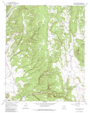
Bull Canyon Topo Map New Mexico
To zoom in, hover over the map of Bull Canyon
USGS Topo Quad 35105d7 - 1:24,000 scale
| Topo Map Name: | Bull Canyon |
| USGS Topo Quad ID: | 35105d7 |
| Print Size: | ca. 21 1/4" wide x 27" high |
| Southeast Coordinates: | 35.375° N latitude / 105.75° W longitude |
| Map Center Coordinates: | 35.4375° N latitude / 105.8125° W longitude |
| U.S. State: | NM |
| Filename: | o35105d7.jpg |
| Download Map JPG Image: | Bull Canyon topo map 1:24,000 scale |
| Map Type: | Topographic |
| Topo Series: | 7.5´ |
| Map Scale: | 1:24,000 |
| Source of Map Images: | United States Geological Survey (USGS) |
| Alternate Map Versions: |
Bull Canyon NM 1966, updated 1971 Download PDF Buy paper map Bull Canyon NM 1966, updated 1980 Download PDF Buy paper map Bull Canyon NM 2002, updated 2003 Download PDF Buy paper map Bull Canyon NM 2011 Download PDF Buy paper map Bull Canyon NM 2013 Download PDF Buy paper map Bull Canyon NM 2017 Download PDF Buy paper map |
| FStopo: | US Forest Service topo Bull Canyon is available: Download FStopo PDF Download FStopo TIF |
1:24,000 Topo Quads surrounding Bull Canyon
> Back to 35105a1 at 1:100,000 scale
> Back to 35104a1 at 1:250,000 scale
> Back to U.S. Topo Maps home
Bull Canyon topo map: Gazetteer
Bull Canyon: Reservoirs
Chavez Tanks elevation 2122m 6961′Horse Tank elevation 2114m 6935′
Isaque Tank elevation 2098m 6883′
Ojo Tank elevation 2057m 6748′
Salado Tank elevation 2129m 6984′
Sarapio Tank elevation 2170m 7119′
Bull Canyon: Springs
Ojo Abajeños elevation 2018m 6620′Ojo de la Vaca elevation 2021m 6630′
Bull Canyon: Streams
Cañada Colorado elevation 1927m 6322′Cañada de la Vaca elevation 2023m 6637′
Ortega Creek elevation 2156m 7073′
Padre Spring Creek elevation 2139m 7017′
Bull Canyon: Valleys
Arroyo Salado elevation 2023m 6637′Bobcat Canyon elevation 2000m 6561′
Bull Canyon elevation 1905m 6250′
Pine Canyon elevation 1909m 6263′
Bull Canyon: Wells
Cow Spring Water Well elevation 2074m 6804′Elsie Well elevation 1954m 6410′
Water Well 10207 elevation 1899m 6230′
Bull Canyon digital topo map on disk
Buy this Bull Canyon topo map showing relief, roads, GPS coordinates and other geographical features, as a high-resolution digital map file on DVD:


