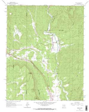
Pecos Topo Map New Mexico
To zoom in, hover over the map of Pecos
USGS Topo Quad 35105e6 - 1:24,000 scale
| Topo Map Name: | Pecos |
| USGS Topo Quad ID: | 35105e6 |
| Print Size: | ca. 21 1/4" wide x 27" high |
| Southeast Coordinates: | 35.5° N latitude / 105.625° W longitude |
| Map Center Coordinates: | 35.5625° N latitude / 105.6875° W longitude |
| U.S. State: | NM |
| Filename: | o35105e6.jpg |
| Download Map JPG Image: | Pecos topo map 1:24,000 scale |
| Map Type: | Topographic |
| Topo Series: | 7.5´ |
| Map Scale: | 1:24,000 |
| Source of Map Images: | United States Geological Survey (USGS) |
| Alternate Map Versions: |
Pecos NM 1961, updated 1966 Download PDF Buy paper map Pecos NM 1961, updated 1972 Download PDF Buy paper map Pecos NM 2002, updated 2003 Download PDF Buy paper map Pecos NM 2002, updated 2006 Download PDF Buy paper map Pecos NM 2011 Download PDF Buy paper map Pecos NM 2013 Download PDF Buy paper map Pecos NM 2017 Download PDF Buy paper map |
| FStopo: | US Forest Service topo Pecos is available: Download FStopo PDF Download FStopo TIF |
1:24,000 Topo Quads surrounding Pecos
> Back to 35105e1 at 1:100,000 scale
> Back to 35104a1 at 1:250,000 scale
> Back to U.S. Topo Maps home
Pecos topo map: Gazetteer
Pecos: Lakes
Monastery Lake elevation 2127m 6978′Pecos: Mines
Fairview Lode Mine elevation 2456m 8057′Kennedy elevation 2309m 7575′
Pecos: Parks
Pecos Historical Marker elevation 2114m 6935′Pecos National Historical Park elevation 2111m 6925′
Pecos National Monument Historical Marker elevation 2111m 6925′
Pecos State Monument elevation 2110m 6922′
Pecos: Populated Places
East Pecos elevation 2114m 6935′La Cueva elevation 2234m 7329′
Pecos elevation 2110m 6922′
Pecos: Post Offices
Pecos Post Office elevation 2110m 6922′Pecos: Springs
Ojito Escondido elevation 2495m 8185′Pecos: Streams
Glorieta Creek elevation 2054m 6738′Pecos: Summits
Cerro de Escobas elevation 2499m 8198′Glorieta Mesa elevation 2499m 8198′
Rowe Peak elevation 2453m 8047′
Pecos: Valleys
Alamitos Canyon elevation 2098m 6883′Cañon de la Madera elevation 2115m 6938′
Cañon de los Trigos elevation 2062m 6765′
Cañon de Manzanita elevation 2026m 6646′
La Cueva Canyon elevation 2155m 7070′
Pecos digital topo map on disk
Buy this Pecos topo map showing relief, roads, GPS coordinates and other geographical features, as a high-resolution digital map file on DVD:


