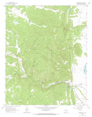
Montezuma Topo Map New Mexico
To zoom in, hover over the map of Montezuma
USGS Topo Quad 35105f3 - 1:24,000 scale
| Topo Map Name: | Montezuma |
| USGS Topo Quad ID: | 35105f3 |
| Print Size: | ca. 21 1/4" wide x 27" high |
| Southeast Coordinates: | 35.625° N latitude / 105.25° W longitude |
| Map Center Coordinates: | 35.6875° N latitude / 105.3125° W longitude |
| U.S. State: | NM |
| Filename: | o35105f3.jpg |
| Download Map JPG Image: | Montezuma topo map 1:24,000 scale |
| Map Type: | Topographic |
| Topo Series: | 7.5´ |
| Map Scale: | 1:24,000 |
| Source of Map Images: | United States Geological Survey (USGS) |
| Alternate Map Versions: |
Montezuma NM 1961, updated 1965 Download PDF Buy paper map Montezuma NM 1961, updated 1965 Download PDF Buy paper map Montezuma NM 2002, updated 2003 Download PDF Buy paper map Montezuma NM 2010 Download PDF Buy paper map Montezuma NM 2013 Download PDF Buy paper map Montezuma NM 2017 Download PDF Buy paper map |
| FStopo: | US Forest Service topo Montezuma is available: Download FStopo PDF Download FStopo TIF |
1:24,000 Topo Quads surrounding Montezuma
> Back to 35105e1 at 1:100,000 scale
> Back to 35104a1 at 1:250,000 scale
> Back to U.S. Topo Maps home
Montezuma topo map: Gazetteer
Montezuma: Arroyos
Sanguijuela Arroyo elevation 2141m 7024′Montezuma: Canals
Storrie Intake Canal elevation 2030m 6660′Montezuma: Dams
Bradner Dam elevation 2068m 6784′Las Vegas Irrigation Project Diversion Dam Historic Site elevation 2048m 6719′
Peterson Dam elevation 2068m 6784′
Storrie Dam elevation 2012m 6601′
Montezuma: Mines
Los Vigiles elevation 2081m 6827′Montezuma: Populated Places
El Llano elevation 2043m 6702′Gallinas elevation 2161m 7089′
Hot Springs elevation 2064m 6771′
Las Dispensas elevation 2303m 7555′
Los Vigiles elevation 2039m 6689′
Montezuma elevation 2048m 6719′
Trout Springs elevation 2153m 7063′
Montezuma: Post Offices
Hot Springs Post Office (historical) elevation 2064m 6771′Los Vigiles Post Office (historical) elevation 2039m 6689′
Montezuma Post Office (historical) elevation 2048m 6719′
Montezuma: Reservoirs
Bradner Reservoir elevation 2068m 6784′Peterson Reservoir elevation 2068m 6784′
Storie Lake elevation 2012m 6601′
Montezuma: Ridges
La Sierrita elevation 2474m 8116′Montezuma: Streams
Cañada de Cerro Colorado elevation 2037m 6683′Montezuma: Valleys
Berts Canyon elevation 2220m 7283′Cañon Alto elevation 2195m 7201′
Cañon de Medio elevation 2183m 7162′
Cañon de Ojo Sabina elevation 2138m 7014′
Cañon del Agua elevation 2085m 6840′
Jarita Canyon elevation 2250m 7381′
Lime Canyon elevation 2045m 6709′
Sandoval Canyon elevation 2175m 7135′
Sebastian Canyon elevation 2039m 6689′
Trout Springs Canyon elevation 2138m 7014′
Montezuma digital topo map on disk
Buy this Montezuma topo map showing relief, roads, GPS coordinates and other geographical features, as a high-resolution digital map file on DVD:


