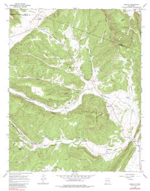
Sapello Topo Map New Mexico
To zoom in, hover over the map of Sapello
USGS Topo Quad 35105g3 - 1:24,000 scale
| Topo Map Name: | Sapello |
| USGS Topo Quad ID: | 35105g3 |
| Print Size: | ca. 21 1/4" wide x 27" high |
| Southeast Coordinates: | 35.75° N latitude / 105.25° W longitude |
| Map Center Coordinates: | 35.8125° N latitude / 105.3125° W longitude |
| U.S. State: | NM |
| Filename: | o35105g3.jpg |
| Download Map JPG Image: | Sapello topo map 1:24,000 scale |
| Map Type: | Topographic |
| Topo Series: | 7.5´ |
| Map Scale: | 1:24,000 |
| Source of Map Images: | United States Geological Survey (USGS) |
| Alternate Map Versions: |
Sapello NM 1965, updated 1968 Download PDF Buy paper map Sapello NM 1965, updated 1980 Download PDF Buy paper map Sapello NM 2002, updated 2003 Download PDF Buy paper map Sapello NM 2010 Download PDF Buy paper map Sapello NM 2013 Download PDF Buy paper map Sapello NM 2017 Download PDF Buy paper map |
| FStopo: | US Forest Service topo Sapello is available: Download FStopo PDF Download FStopo TIF |
1:24,000 Topo Quads surrounding Sapello
> Back to 35105e1 at 1:100,000 scale
> Back to 35104a1 at 1:250,000 scale
> Back to U.S. Topo Maps home
Sapello topo map: Gazetteer
Sapello: Areas
El Valle elevation 2352m 7716′Sapello: Lakes
San Isidro Lake elevation 2229m 7312′Sapello: Populated Places
Canoncito elevation 2205m 7234′Las Tusas elevation 2143m 7030′
Manuelitas elevation 2177m 7142′
Peñasco Blanco elevation 2245m 7365′
San Ignacio elevation 2222m 7290′
Sapello elevation 2124m 6968′
Tierra Monte elevation 2303m 7555′
Sapello: Post Offices
San Ignacio Post Office (historical) elevation 2222m 7290′Sapello Post Office elevation 2124m 6968′
Sapello: Ridges
Fragoso Ridge elevation 2478m 8129′Sapello: Streams
Cañada de Rocio elevation 2171m 7122′Deer Creek elevation 2212m 7257′
Manuelitas Creek elevation 2113m 6932′
Rito Chavez elevation 2243m 7358′
Rito Colorado elevation 2202m 7224′
Sapello: Summits
Cerro de la Cruz elevation 2412m 7913′Sapello: Valleys
Cañon de Cantor elevation 2179m 7148′Canon de Duran elevation 2169m 7116′
Cañon de Horno elevation 2173m 7129′
Cañon de Medio elevation 2197m 7208′
Cañon del Angosto elevation 2136m 7007′
La Canada elevation 2182m 7158′
Sanchez Canyon elevation 2253m 7391′
Sapello digital topo map on disk
Buy this Sapello topo map showing relief, roads, GPS coordinates and other geographical features, as a high-resolution digital map file on DVD:


