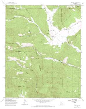
Rociada Topo Map New Mexico
To zoom in, hover over the map of Rociada
USGS Topo Quad 35105g4 - 1:24,000 scale
| Topo Map Name: | Rociada |
| USGS Topo Quad ID: | 35105g4 |
| Print Size: | ca. 21 1/4" wide x 27" high |
| Southeast Coordinates: | 35.75° N latitude / 105.375° W longitude |
| Map Center Coordinates: | 35.8125° N latitude / 105.4375° W longitude |
| U.S. State: | NM |
| Filename: | o35105g4.jpg |
| Download Map JPG Image: | Rociada topo map 1:24,000 scale |
| Map Type: | Topographic |
| Topo Series: | 7.5´ |
| Map Scale: | 1:24,000 |
| Source of Map Images: | United States Geological Survey (USGS) |
| Alternate Map Versions: |
Rociada NM 1965, updated 1968 Download PDF Buy paper map Rociada NM 2002, updated 2003 Download PDF Buy paper map Rociada NM 2011 Download PDF Buy paper map Rociada NM 2013 Download PDF Buy paper map Rociada NM 2017 Download PDF Buy paper map |
| FStopo: | US Forest Service topo Rociada is available: Download FStopo PDF Download FStopo TIF |
1:24,000 Topo Quads surrounding Rociada
> Back to 35105e1 at 1:100,000 scale
> Back to 35104a1 at 1:250,000 scale
> Back to U.S. Topo Maps home
Rociada topo map: Gazetteer
Rociada: Flats
Bluebell Park elevation 3043m 9983′Rociada: Forests
Las Vegas Ranger District elevation 2915m 9563′Rociada: Mines
Azure Mine elevation 2719m 8920′Good Hope Mine elevation 2417m 7929′
Iron Hole Mine elevation 2848m 9343′
Joe and Jenny Prospect elevation 2369m 7772′
Joe Matt and Sam Adams Mine elevation 2528m 8293′
Lepidolite Shaft elevation 2801m 9189′
Loring Mine elevation 2467m 8093′
Martinez Pit elevation 2285m 7496′
Pidlite Pegmatite elevation 2861m 9386′
Rising Sun Mine elevation 2803m 9196′
Smith Mine elevation 2371m 7778′
Rociada: Populated Places
Pendaries Village elevation 2410m 7906′Rociada elevation 2297m 7536′
Upper Rociada elevation 2331m 7647′
Rociada: Post Offices
Rociada Post Office elevation 2297m 7536′Rociada: Ridges
Bluebell Ridge elevation 2924m 9593′Rociada: Springs
Aspen Spring elevation 2654m 8707′Refrigeration Springs elevation 2584m 8477′
Rociada: Streams
Daily Creek elevation 2338m 7670′Left Hand Sapello River elevation 2645m 8677′
Maestas Creek elevation 2411m 7910′
Rito San Jose elevation 2277m 7470′
Sparks Creek elevation 2411m 7910′
Rociada: Summits
Lone Pine Mesa elevation 2968m 9737′Rociada: Valleys
Capulin Canyon elevation 2347m 7700′Cascade Canyon elevation 2474m 8116′
Denton Canyon elevation 2646m 8681′
Hollinger Canyon elevation 2497m 8192′
Johns Canyon elevation 2551m 8369′
Rociada digital topo map on disk
Buy this Rociada topo map showing relief, roads, GPS coordinates and other geographical features, as a high-resolution digital map file on DVD:


