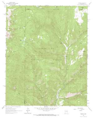
Cowles Topo Map New Mexico
To zoom in, hover over the map of Cowles
USGS Topo Quad 35105g6 - 1:24,000 scale
| Topo Map Name: | Cowles |
| USGS Topo Quad ID: | 35105g6 |
| Print Size: | ca. 21 1/4" wide x 27" high |
| Southeast Coordinates: | 35.75° N latitude / 105.625° W longitude |
| Map Center Coordinates: | 35.8125° N latitude / 105.6875° W longitude |
| U.S. State: | NM |
| Filename: | o35105g6.jpg |
| Download Map JPG Image: | Cowles topo map 1:24,000 scale |
| Map Type: | Topographic |
| Topo Series: | 7.5´ |
| Map Scale: | 1:24,000 |
| Source of Map Images: | United States Geological Survey (USGS) |
| Alternate Map Versions: |
Cowles NM 1961, updated 1966 Download PDF Buy paper map Cowles NM 1961, updated 1969 Download PDF Buy paper map Cowles NM 1961, updated 1973 Download PDF Buy paper map Cowles NM 1961, updated 1987 Download PDF Buy paper map Cowles NM 2002, updated 2003 Download PDF Buy paper map Cowles NM 2011 Download PDF Buy paper map Cowles NM 2013 Download PDF Buy paper map Cowles NM 2017 Download PDF Buy paper map |
| FStopo: | US Forest Service topo Cowles is available: Download FStopo PDF Download FStopo TIF |
1:24,000 Topo Quads surrounding Cowles
> Back to 35105e1 at 1:100,000 scale
> Back to 35104a1 at 1:250,000 scale
> Back to U.S. Topo Maps home
Cowles topo map: Gazetteer
Cowles: Lakes
Lake Johnson elevation 3387m 11112′Spirit Lake elevation 3301m 10830′
Stewart Lake elevation 3120m 10236′
Cowles: Mines
Cowles elevation 2754m 9035′Pecos Mine elevation 2400m 7874′
Cowles: Populated Places
Cowles elevation 2483m 8146′Geronimo elevation 2678m 8786′
Grass Mountain Summer Home Area elevation 2622m 8602′
Holy Ghost elevation 2431m 7975′
Winsor Creek Summer Home elevation 2545m 8349′
Cowles: Post Offices
Cowles Post Office (historical) elevation 2483m 8146′Tererro Post Office (historical) elevation 2399m 7870′
Cowles: Streams
Albright Creek elevation 2597m 8520′Bear Creek elevation 2473m 8113′
Carpenter Creek elevation 2424m 7952′
Cave Creek elevation 2633m 8638′
Doctor Creek elevation 2465m 8087′
Horsethief Creek elevation 2753m 9032′
Jacks Creek elevation 2511m 8238′
Panchuela Creek elevation 2508m 8228′
Rio Mora elevation 2405m 7890′
Rito Oscuro elevation 2749m 9019′
Rito Perro elevation 2879m 9445′
Willow Creek elevation 2370m 7775′
Winsor Creek elevation 2483m 8146′
Cowles: Summits
Grass Mountain elevation 3002m 9849′Redondo Peak elevation 3746m 12290′
Round Mountain elevation 3292m 10800′
Cowles digital topo map on disk
Buy this Cowles topo map showing relief, roads, GPS coordinates and other geographical features, as a high-resolution digital map file on DVD:


